Motorcycle Corner
Trips & day ride blogs
Projects & modification how-to
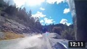
 Motorcycle dashcam (F800GS) |
 Motorcycle dashcam (DRZ400S) |
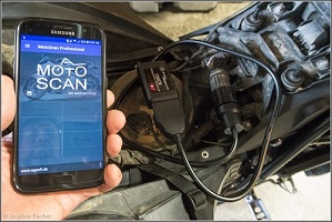 BMW CAN bus diagnostics port for resetting service intervals and trouble codes |
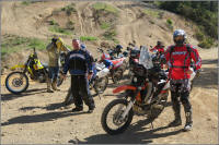
Event photos
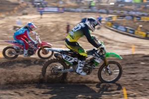 Hangtown Motorcross races May 2013 |
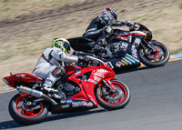 AFM Sonoma sportbike races May 2015 |
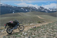
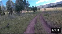
GPS tracks and maps of favorite rides
Number of rides listed: 42
| Route Description | Map | GPX file | Notes | Difficulty |
| Alaska and Canada to the Arctic Sea at Tuktoyaktuk and back |
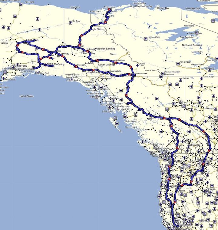 |
See the GPS track list (by each day) in the summary of the Alaska-Canada ride description here | 9000 miles roundtrip over 29 days from Sacramento to Canada, up to Tuktoyaktuk, and into Alaska. See the blog: Alaska-Canada ride for details | 2 ~ 3 |
| Baja, Mexico from the border at Tecate to Cabo San Lucas and back |
|
See the GPS track list (by each day) in the summary of the Baja ride description here | 2000 miles roundtrip over 9 days, following more of the Pacific down, and the Sea of Cortez back up. See the blog on the Baja exploration for details | 2 ~ 3.5 |
| Carrizo Plain loop |
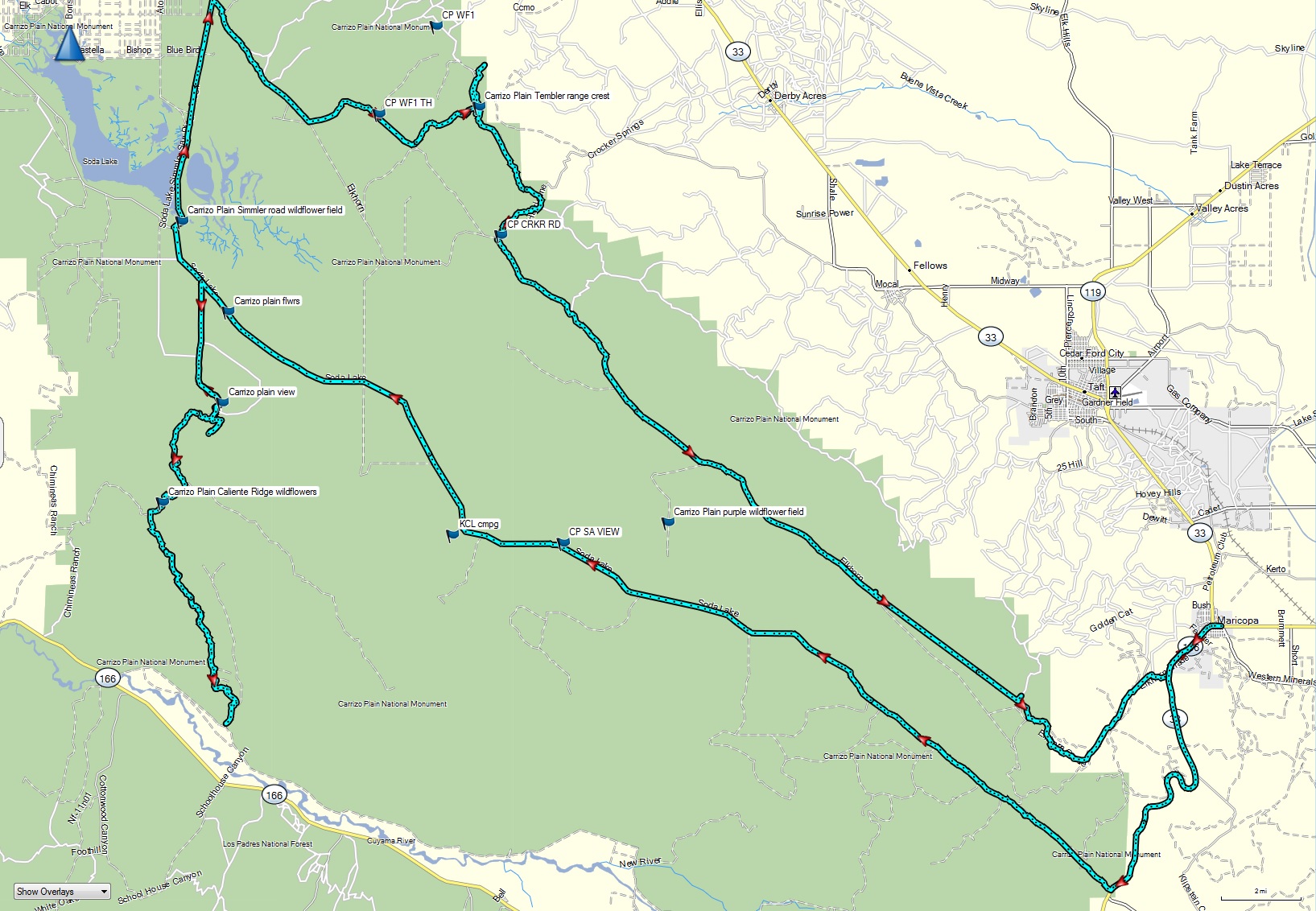 |
Carrizo Plain dual sport loop.gpx | Mostly dirt, most well graded, but some more technical climbs on the east side into the Tembler Mtns. Best done in the early spring when wildflowers are out. | 3 |
| Continental Divide Route from Mexico to Canada, traversing the states of New Mexico, Colorado, Wyoming, Idaho, and Montana. |
|
See the GPS track list (by each day) in the summary of the CDR ride description here | 3000 miles following the spine of the Continental Divide from Mexico to Canada, about 80-90% off road. See the blog on the Great Continental Divide ride above for more details | 2 ~ 3.5 |
| Coyote Flat out of Bishop |
 |
CYFL - Coyote Flat out of Bishop dual sport route.gpx | Long stretches of deep sand on flat, and relatively steep initial switchback climb with deep ruts. See day 5 of the Eastern Sierra ride blog for more details. | 4 |
| Cache Creek, Bear Valley, Indian Valley, Upper Clear Lake, and Lake Pillsbury |
|
Cache Creek Casino, Bear Valley, Indian Valley, Upper Lake, Lake Pillbury loop.gpx | Few minor rutted sections near approach to Indian Valley | 2 |
| California BDR (partial & modified) from Beatty to Yuma in 3.5 days |
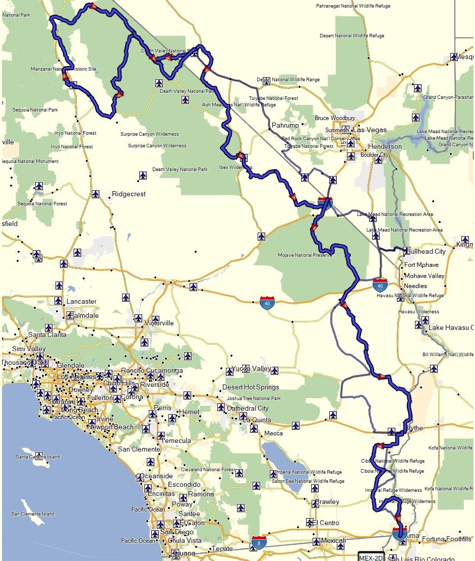 |
CABDR_mod track
day1.gpx CABDR_mod track day 2.gpx CABDR_mod track day 3.gpx CABDR_mod track day 4.1.gpx |
Epic adapted version of the California BDR from north to south starting in Beatty and ending in Yuma. Some tougher sections w deep sand not found on the normal BDR not recommended for bigger adventure bikes | 3.5 |
| Colorado BDR from Cortez to Meeker in 5 days |
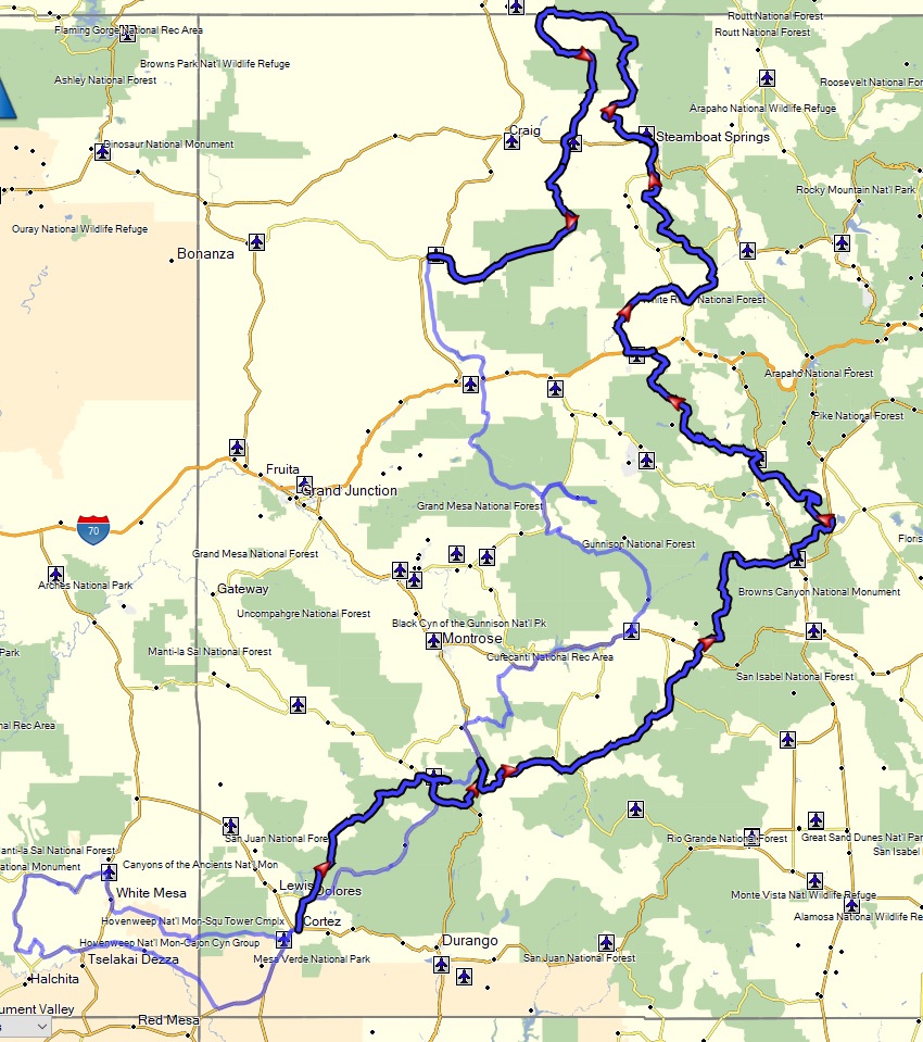 |
COBDR_day1 - Cortez to Ouray.gpx COBDR_day2 - Ouray to Buena Vista.gpx COBDR_day3 - Buena Vista to Eagle.gpx COBDR_day4 - Eagle to Steamboat Springs.gpx COBDR_day5 - Steamboat Springs to Meeker.gpx |
One of the most scenic BDRs of the west. Do-able on a big bike for more experienced riders, but more fun on a DS. Some of the rocky passes and mud when it is raining can be difficult | 3.5 |
| Death Valley: Eureka Dunes, Steel Pass, Saline Valley hot springs day loop |
|
Eureka Dunes - Steel Pass - Saline Valley hot springs loop.gpx | Excellent dual sport ride. Mix of some sand, rocky ledges, loose rock in washes, & fast dirt roads. Great stop to soak at the hot springs | 3.5 |
| Death Valley: Panamint Springs to Darwin and back via 4wd backroad |
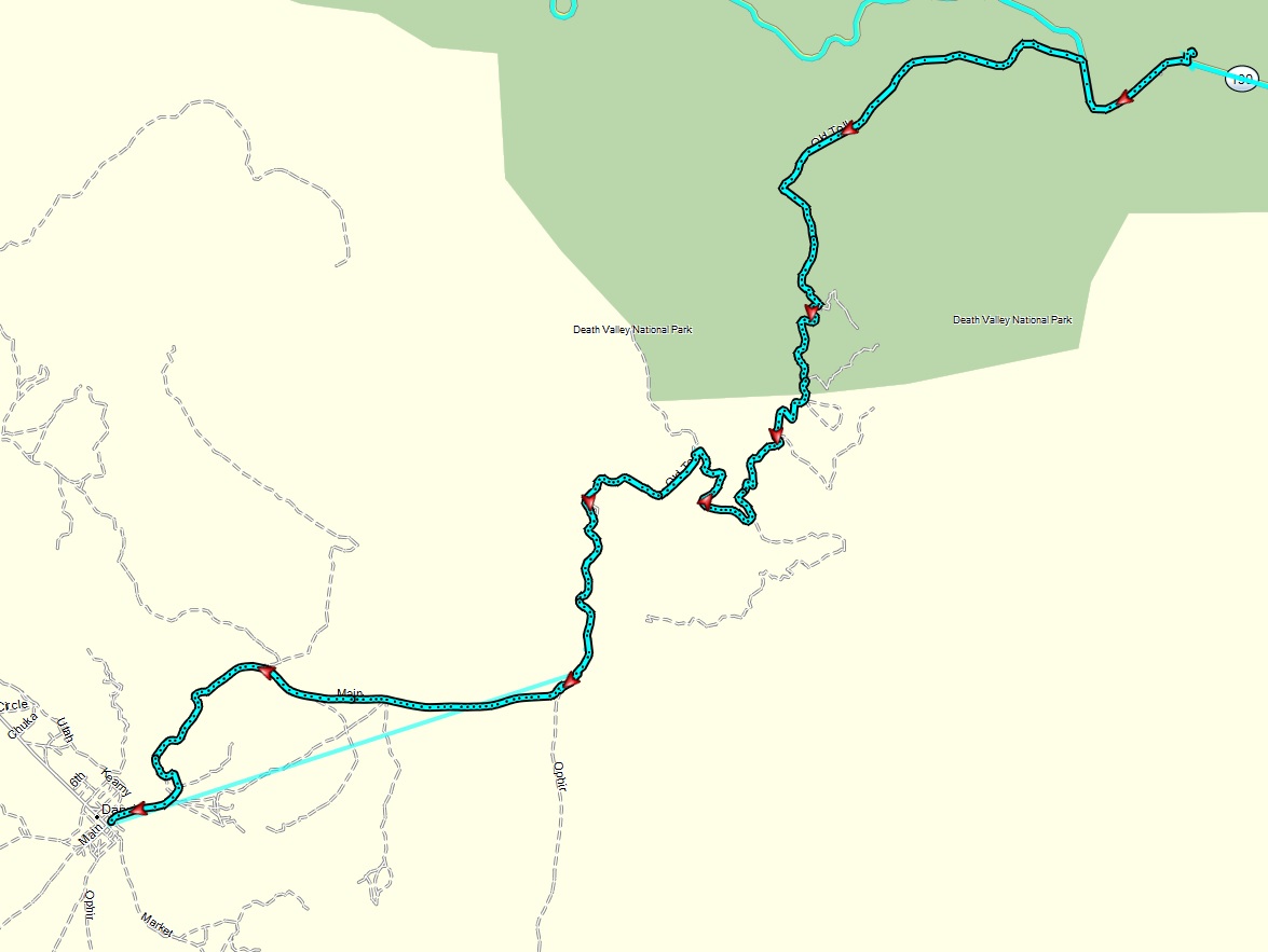 |
Panamint Springs to Darwin 2018.gpx | Good diversity of terrain from some rocky slopes, sand, and washes. Interesting remote town to explore. | 3 |
| Death Valley: Panamint Springs to Saline Hot Springs via Hunter Pass, Racetrack, and Lippencott Pass |
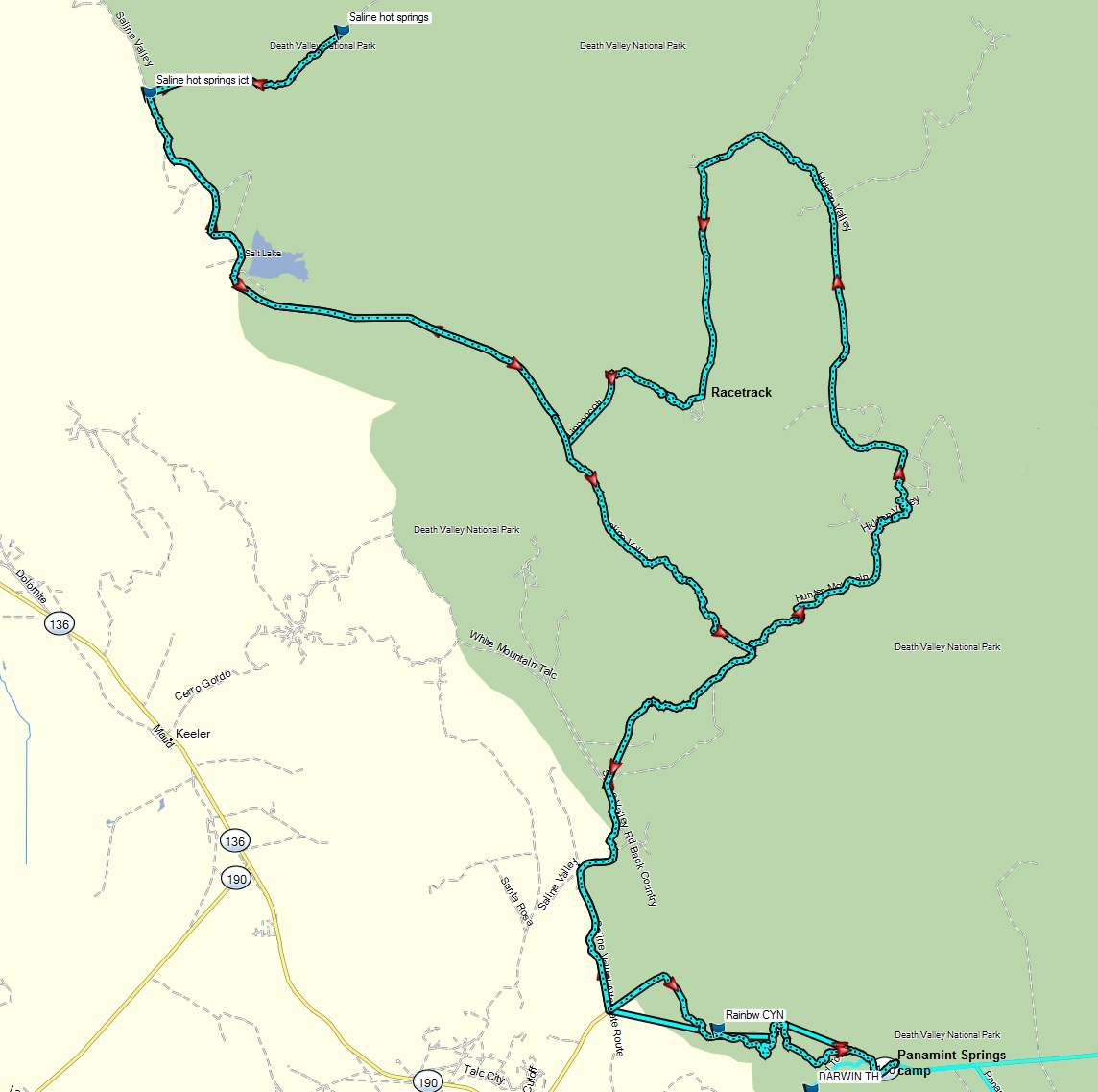 |
Panamint Springs - Hunter Pass - Racetrack - Lippencott - Saline Valley Hot spring loop.gpx | Most technical section on
Lippencott Pass. Epic washboard on the Racetrack road is the
ultimate torture test. See day 2 of the DV Panamint Springs ride blog above for more details. |
3.5 |
| Death Valley: Panamint Springs to Barker Ranch, then down to Bad Water via Westside road to Furnace Creek, then rtn via pavement |
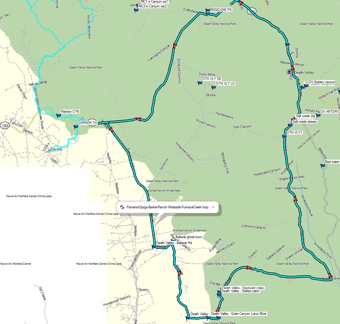 |
PanamintSprgs-BarkerRanch-Westside-FurnaceCreek loop.gpx | Technical sections on Goler
Canyon Pass, plus many sections of loose sand. More of a '3'
up to Barker Ranch. See the day 1 of the DV Panamint Springs ride blog above for more details. |
3.5 |
| Donner Pass train tunnels |
 |
Donner Summit train tunnel dual sport track.gpx | Loose sections on approach to
train tunnel road, otherwise it is a '2'. See the blog above for more details. |
3 |
| Downieville to Quincy via Poker Flat and LaPorte |
|
Downieville to Quincy via LaPorte dual sport route.gpx | Dirt from Downieville to LaPorte, then paved to Quincy. Very hard climb out of Canyon Creek ravine out of Poker Flat makes it a 5, otherwise the dirt is mostly a 3. Water crossing can be deep. | 4.5 |
| Ebbetts Pass to Bear Trap Wilderness |
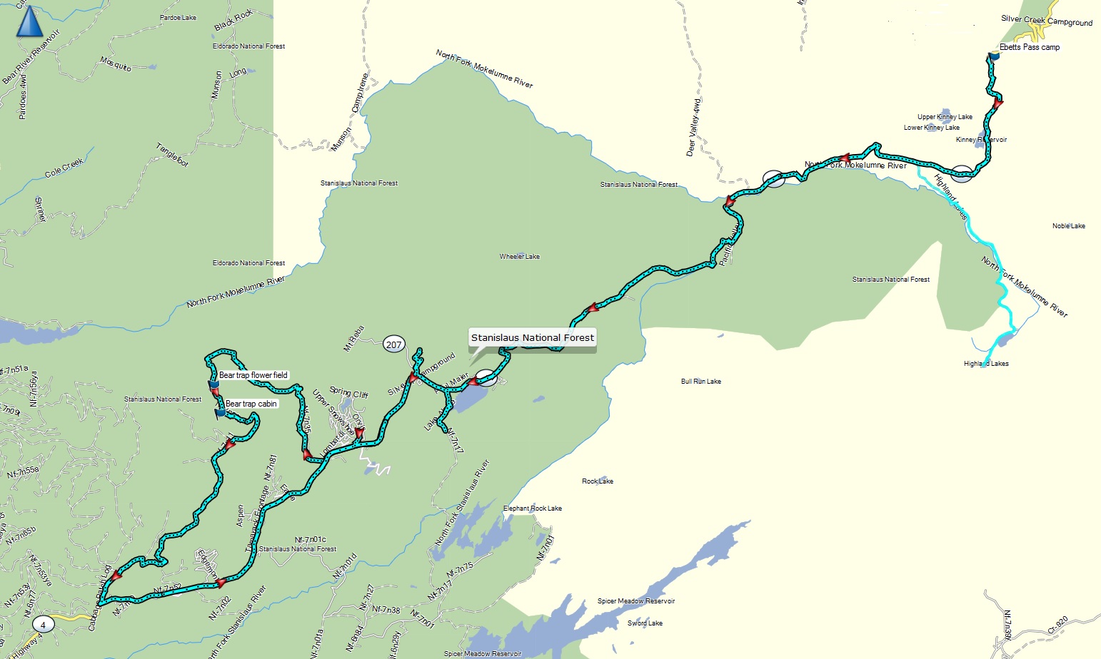 |
Ebetts Pass - Bear Trap ride.gpx | Mix of pavement on Highway 4 and more technical dirt in the Bear Trap wilderness. Later contains lots of rocky, loose and steep climbs | 2/4 |
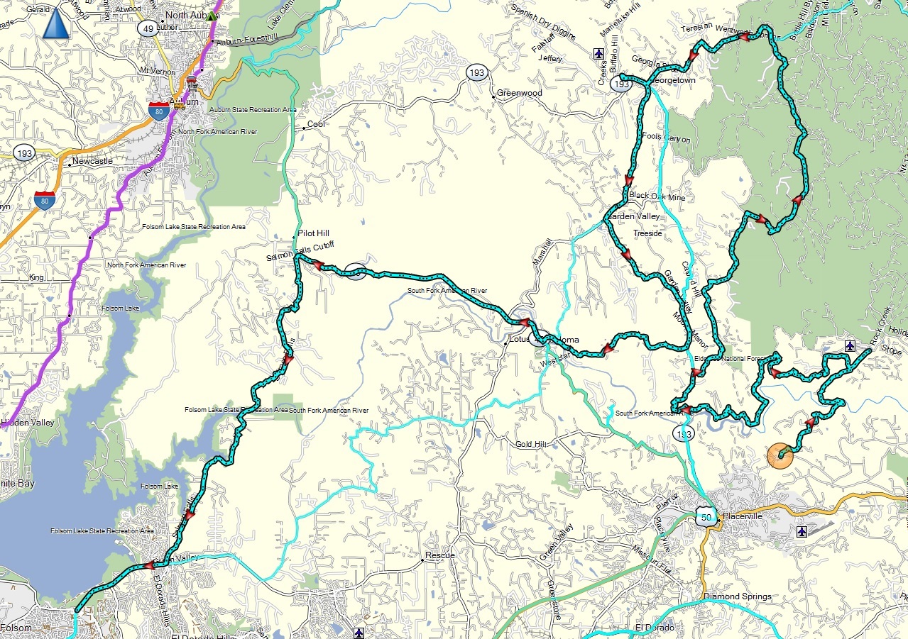
| Folsom - Amador foothills ADV ride |
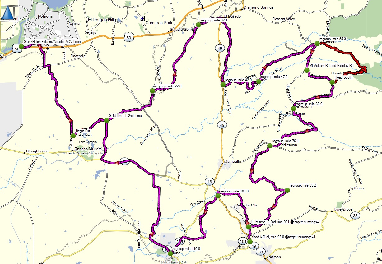 |
Folsom-Amador_foothills_ADV_ride.gpx | Good mix of dirt, scenery, and twisty backroads. Some seasonal water crossings on dirt between Scott and Latrobe. Slightly harder rutted canyon section past Somerset | 2-3 |
| Folsom to Fiddletown, Ione, Sutter Creek, Michigan Bar loop |
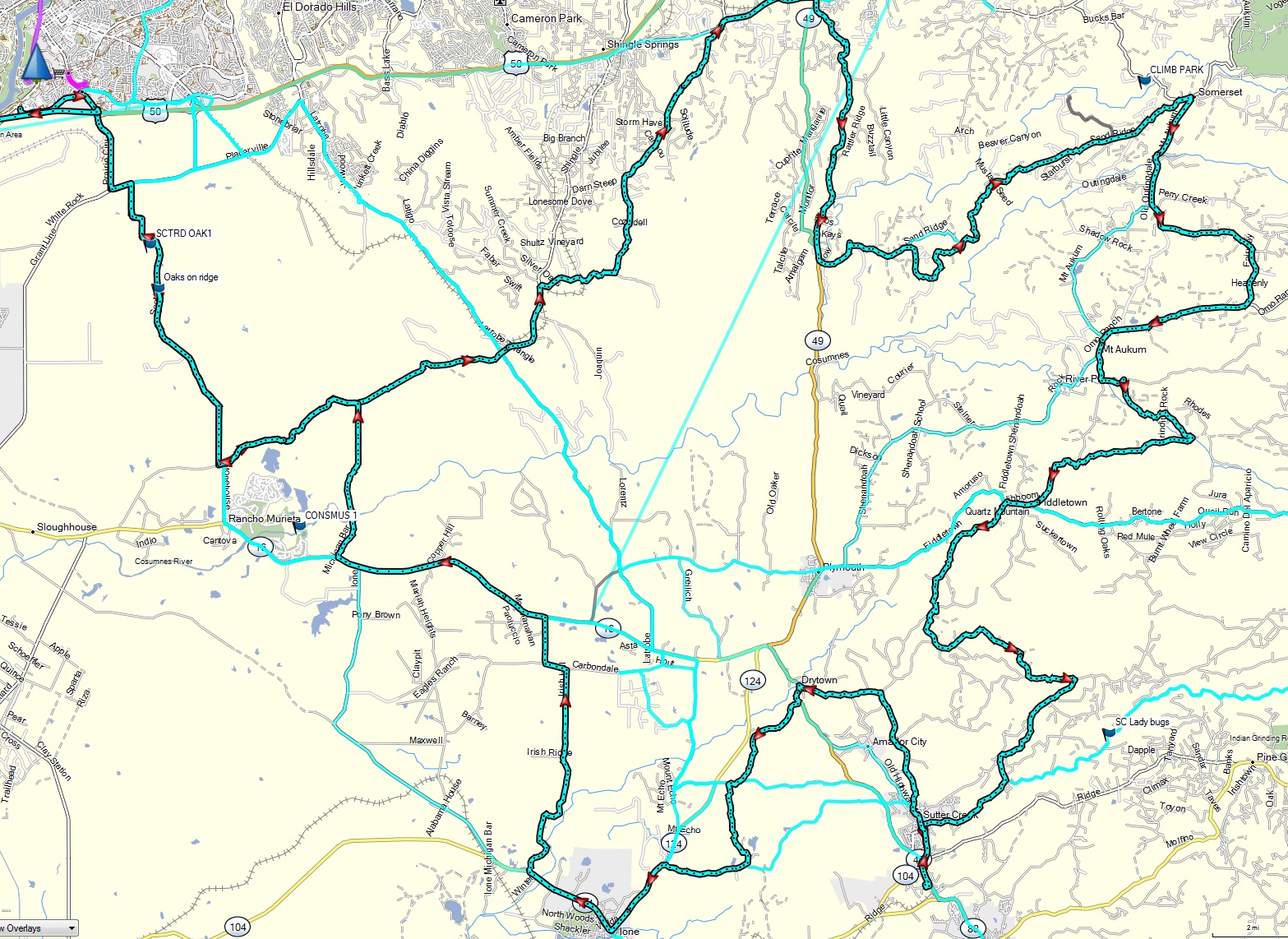 |
Folsom-ElDorado-Somerset-Fiddletown-SutterCrk-Ione-MichiganBar.gpx | Trickest section are some deeper water crossings on dirt between Scott Road and Latrobe and Michigan Bar, plus some mud east of Michigan Bar. Otherwise mostly paved w minor water crossings. | 2 |
| Folsom to Mokelumne Hill to Murphys loop via backroads |
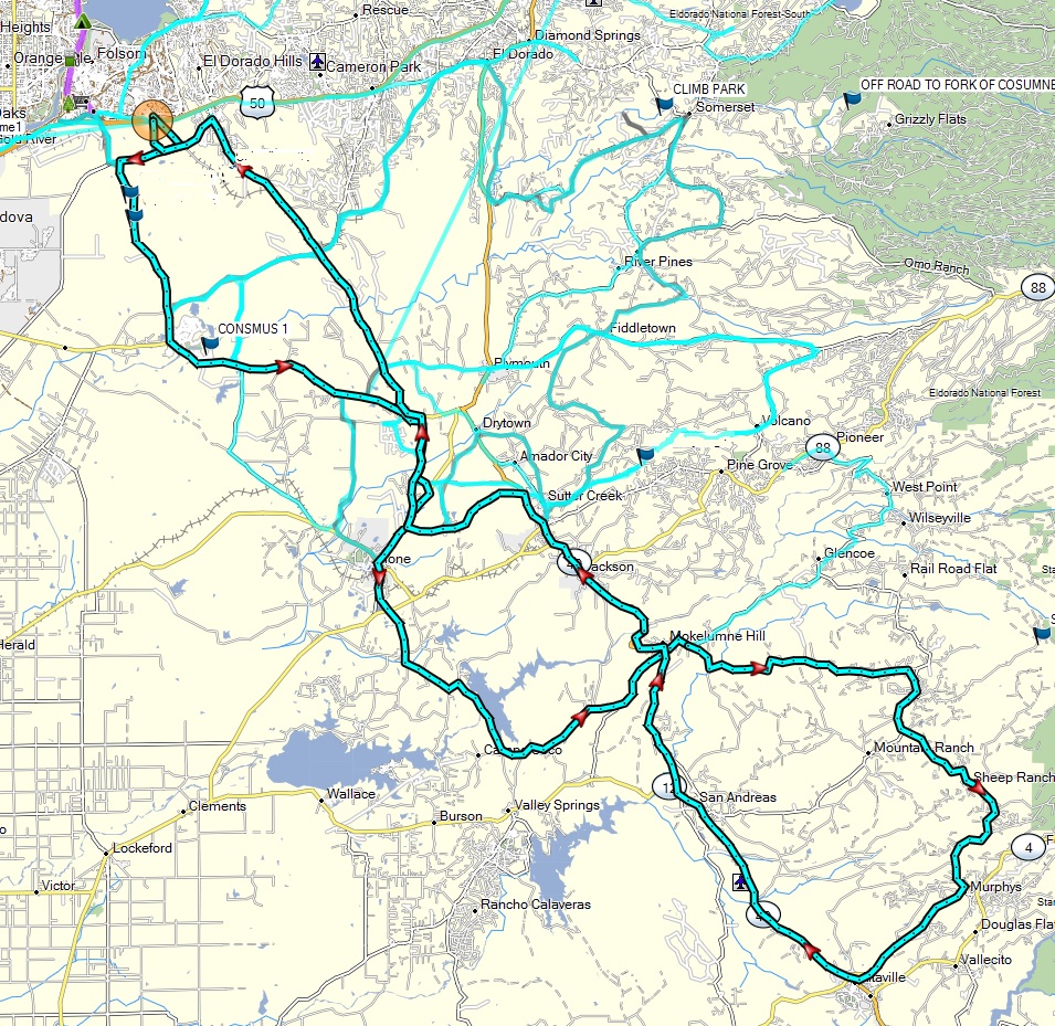 |
Folsom-Ione-PardeeLake-MokelumneHill-SheepRanch-Murphys loop.gpx | Mostly paved except for dirt from Sheep Ranch to Murphys. Can have some mud or sand depending on season. | 2 |
| Folsom, El Dorado, Amador, Calaveras loop with more dirt |
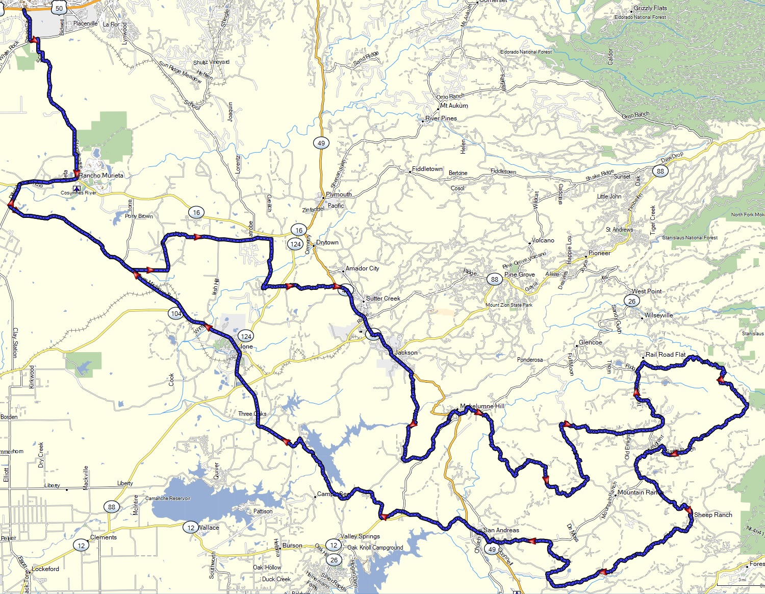 |
ElDorado_Amador_Calaveras_loop_ride_2022-03.gpx | More dirt intensive version of the previous ride also covering Sheep Ranch and Summit Level roads | 3 |
| Foresthill - Colfax - Iowa Hill - Sugar Pine loop |
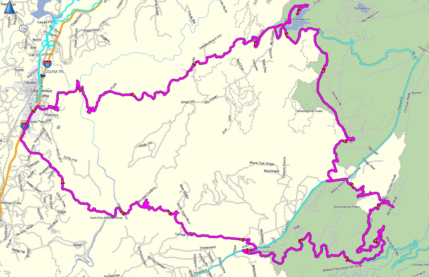 |
Foresthill - Iowa Hill dual sport loop.gpx | Dirt on Yankee Jim from
ForestHill to Colfax, and from Sugar Pine back to Foresthill Road.
Nice twisty climb up Iowa Hill from the north fork. See the blog above for more details. |
2 |
| Foresthill - Mosquito Ridge road - Robinson Flat - Soda Springs - Nevada City loop |
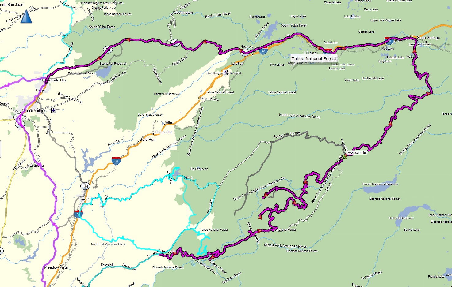 |
Foresthill-MosquitoRidge-RobinsonFlat-SodaSprings loop.gpx | Foresthill down Mosquito Ridge (twisty asphalt), Robinson Flat and Soda Springs via dirt/rocky trail (few steep sections & water crossings), then back to Nevada City on highway 40 and 20. Good adventure bike challenge. | 3 |
| Gardnerville - Diamond Valley - Indian Creek - Monitor Pass backroads |
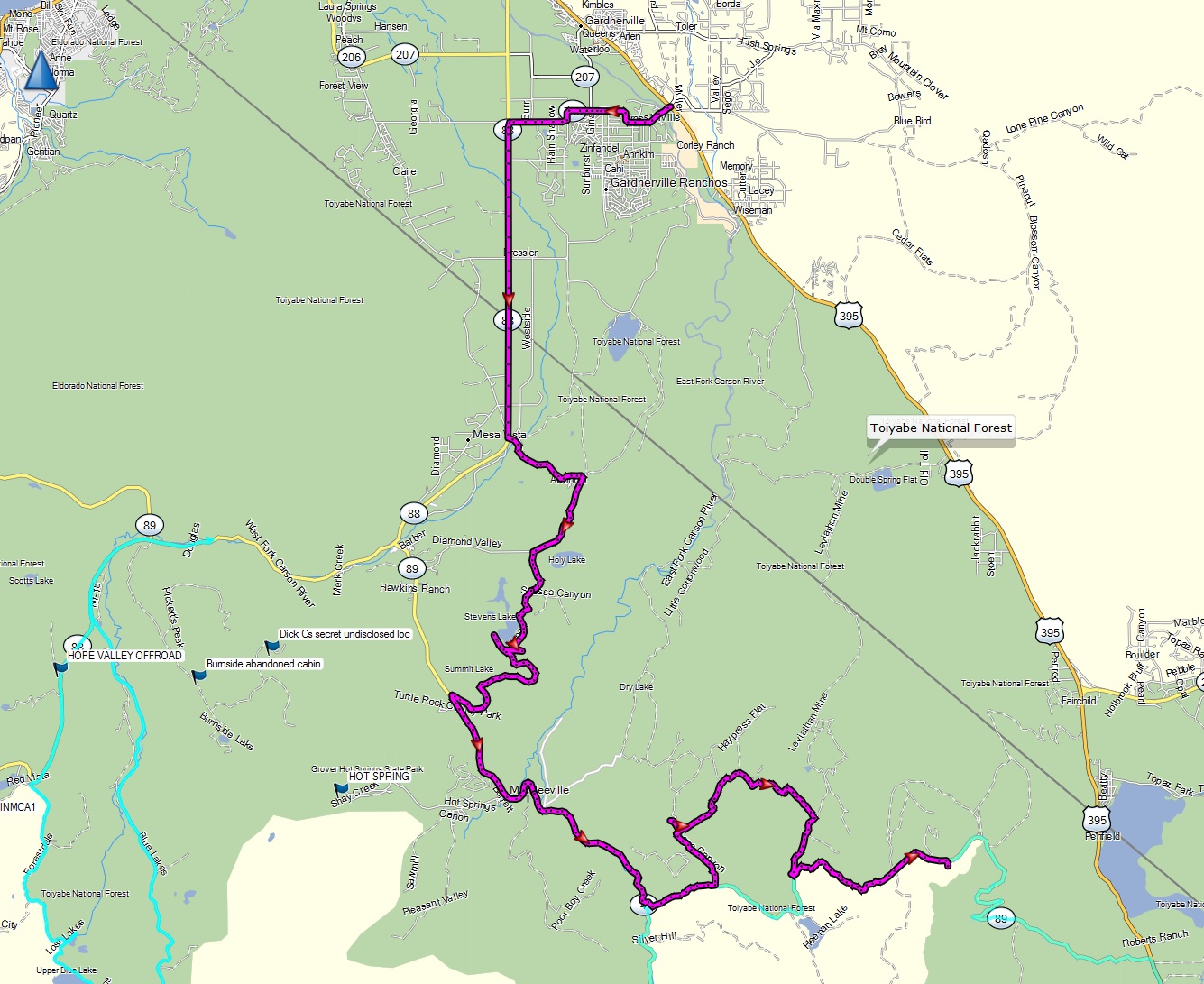 |
Gardnerville - Diamond Valley - Indian Creek - Monitor Pass backroads dual sport.gpx | Most challenging dirt and large loose rock on Monitor Pass backroad, otherwise this is a '2'. | 3 |
| Georgetown - French Meadows - Foresthill backroad |
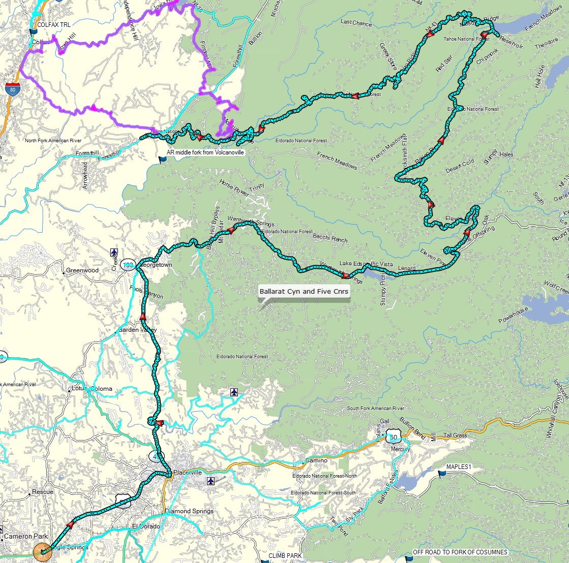 |
Georgetown - French Meadows - Foresthill loop.gpx | Mostly paved, with a few rough
sections between Wentworth Springs and French Meadows |
1.5 |
| Hope Valley - Red Lake to Blue Lakes over Red Pass, and then back as a loop |
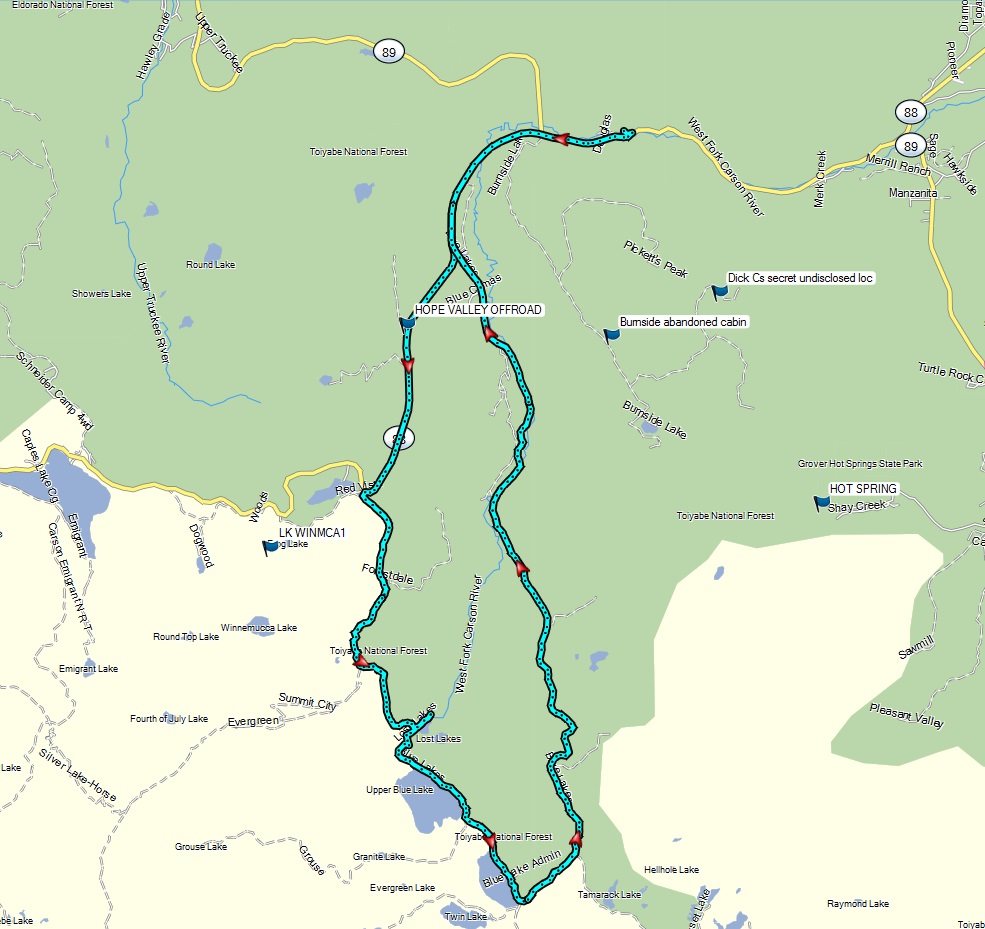 |
Hope Valley - Red Pass - Blue Lakes loop.gpx | Rocky sections over Red Pass and descent into the Blue Lakes basin. | 3.5 |
| Lockhart Basin from Moab, Utah to the Needles Outpost in the Canyonlands |
|
Lockhart_Basin_north_to_south.gpx | Epic scenery, with countless steep and rocky sections, with some sand. Rated for experts riders only. Alternate leg of the Utah BDR. Agile dual sports only. Should only be taken with other riders to help get the bikes thru. | 4.5 |
| Mono Craters backroads via Taylor Canyon |
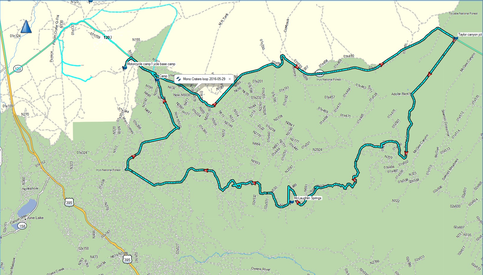 |
Mono Craters loop.gpx | Sections of very loose volcanic ash, akin to coarse sand. Some fun sections with sweeping turns on big berms of loose ash. Best done on a dual sport. | 3.5 |
| Morrison Divide trail off the Colorado BDR |
|
CO_Morrison_Divide_trail.gpx | A more difficult 13 mile tributary loop off the Colorado BDR. More suitable for a dual sport due to a more single track nature, steepness, and mud | 4 |
| Nevada City to Downieville via Malakoff Diggins, Alleghany, and Galloway street |
 |
Yuba River Nevada City to Downieville.gpx | Lots of dirt with a few rougher sections. Steep descent on looser dirt to Downieville on Galloway street. | 3.5 |
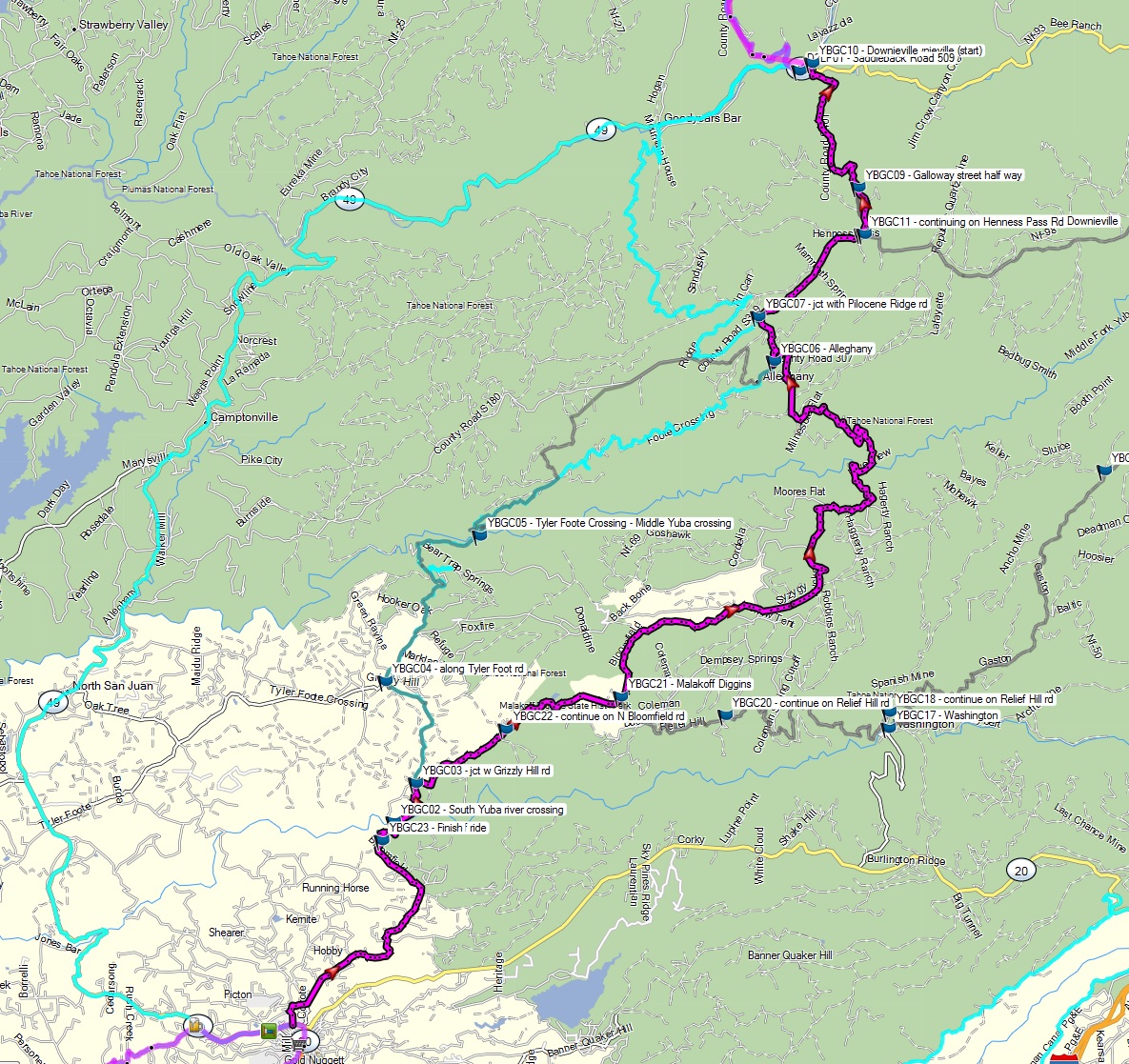
| Nevada City - Downieville - Jackson Meadows - Washington Loop |
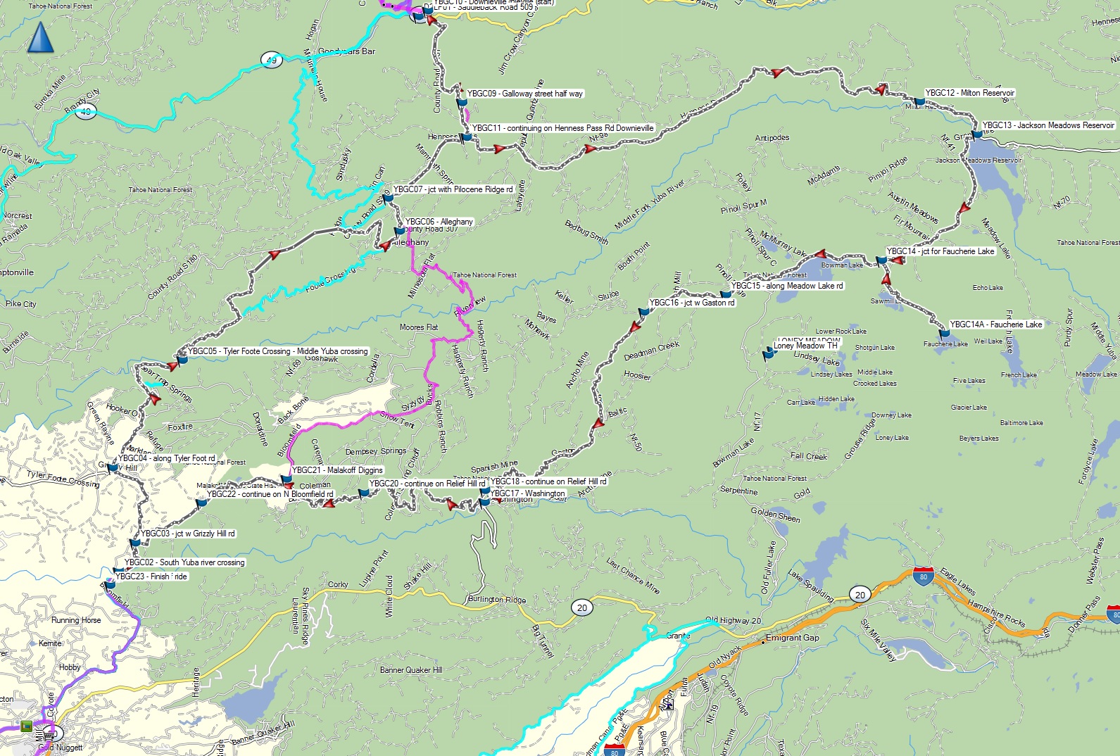 |
YBGC - Yuba River gold country loop from Nevada City to Downieville and back.gpx | Long ride: Lots of technical sections with babyhead sized boulder fields between Jackson Meadows and Washington. See the Nevada City - Downieville ride blog for more details. | 4 |
| Nevada City to Downieville via Mountain House and Goodyear Bar, then up to the Saddleback mtn fire lookout, return on highway via 49 |
|
NevadaCity-Downieville-Saddleback-loop.gpx | Mountain House+Goodyear Bar route from Nevada City to Downieville, but Tyler Foote Crossing can be rocky and rutted near Yuba middle fork. | 3.5 |
| North Coast 1: Leggett to Sinkyone, Shelter Cove, Kings Range, back down PCH to Salt Point |
|
North Coast - Leggett to Sinkyone, Shelter Cove, along the PCH to Salt Point.gpx | Mix of pavement and well graded dirt. Most rutted sections along Usal Road and Kings Peak Road. Well suited for a bigger adventure bike. | 2.5 |
| North Coast 2: Fort Bragg to Sinkyone (Lost Coast), Shelter Cover, and Garberville. Loop ride via PCH, Usal Road, Kings Peak Road, Wilder Canyon, and back via Highway 101/1 |
|
Fort Bragg, Usal Road, Needles, Shelter Cove, Kings Peak, Garberville, and back.gpx | Epic ride with incomparable scenery. Usal Road and Saddle Mountain (steep loose rock) via Kings Peak are the most challenging. Usal could be a nightmare if wet and muddy. Best on a dual sport. | 3.5 |
| Placerville via Mosquito Rd to the old Bret Harte hotel site, then to Georgetown via Rock Creek Rd. |
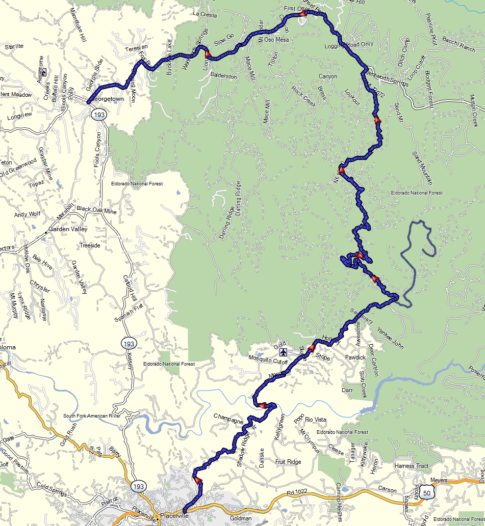 |
Placerville-MosquitoRd-Georgetown-Coloma-Folsom.gpx | Good terrain of dirt bracketed by twisty asphalt on either end. Mosquito Rd and path to Bret Harte tends to be muddy when wet. | 3 |
| Placerville at Mosquito Rd to Georgetown, then Coloma, and ending in Folsom via back road dirt and twisty asphalt. |
 |
Placerville-MosquitoRd-Georgetown-Coloma-Folsom.gpx | Good backroad dirt and asphalt twisties route. Condition tends to be good. | 2 |
| Sheet Iron route: Stonyford to Fort Bragg via Sherwood Road. |
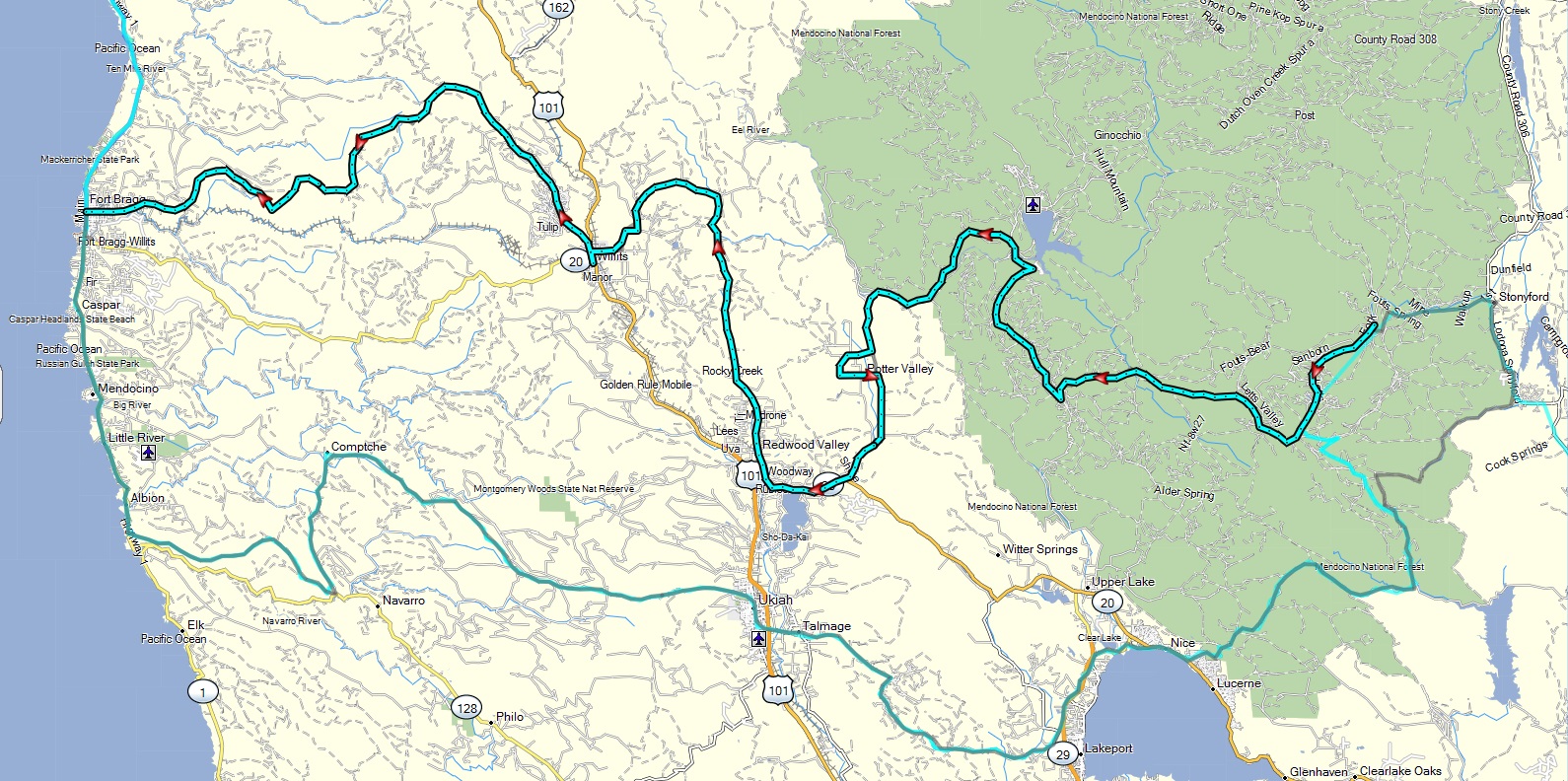 |
Stonyford to Fort Bragg SheetIron.gpx | Great dual sport ride. Mix of conditions: Rocky and rutted with some steeper hills. Sherwood road is awesome, but prone to mud when wet. | 3.5 |
| Sheet Iron return route (modified): Fort Bragg to Letts Lake at Stonyford via Clear Lake |
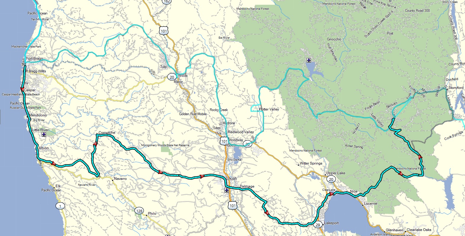 |
Fort Bragg to Letts Lake via Clear Lake SheetIron return.gpx | Mix of trail conditions, but not as technical at Sheet Iron day 1 route. Thus a bit more big bike friendly. One moderate water crossing from Bartlett Springs toward Stonyford. | 3 |
| Sweetwater Mountains: Desert Creek to Lobdell Lake |
|
Sweetwaters Desert Creek camp to Lobdell Lake and back.gpx | Rocky and rutted sections on some steep climbs plus some mud. Best done on a dual sport. See the Sweetwater mtns ride blog for more details. | 3.5 |
| Tahoe Rim Trail east side |
|
Tahoe rim trail east dual sport.gpx | Lots of short technical sections, including steeper climbs, babyhead rocks and sand. | 4 |
| Truckee to Martis Peak and down to Kings Beach |
 |
Truckee to Tahoe via Martis Creek and peak dual sport.gpx | Mix of paved and dirt roads in reasonable condition | 3 |
| Truckee loop out to Stampede Reservoir, Verdi, and Babbits Peak |
|
Truckee_Stampede_Verdi_BabbitsPeak_loop.gpx | Big variety of conditions with steep climbs, rutted sections, loose dirt | 3.5 |
| Volcanic Tablelands out of Bishop |
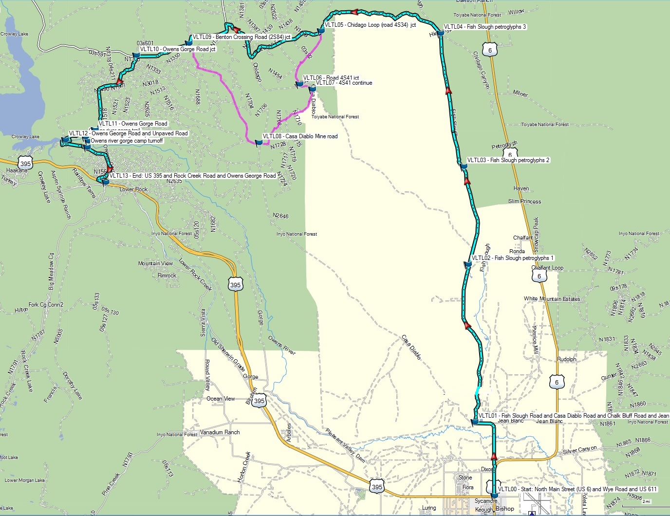 |
Volcanic tablelands dual sport track.gpx Volcanic tablelands adv bike track (easier).gpx |
Relatively maintained dirt
roads, composted mostly packed volcanic ash. See day 4 of the Eastern Sierras ride blog above for more details. |
2/3 |
| White Rim Trail of Canyonlands National Park, Utah |
|
White_Rim_trail loop_Potash_road_Moab.gpx | One of the most scenic dual sport rides of the American Southwest. Wide mix of terrain including rocky slopes, sand, and mud when wet. Best done on a dual sport. Permit required. | 3.5 |
Videos of rides
Epic multi-day adventure bike rides
 Dawson City, Yukon to Tuktoyaktuk of the Northwest Territories on the Arctic Ocean 575 miles in 2.5 days via the Dempster Highway. YouTube version Higher quality/bandwidth personal library version Lower bandwidth version |
Pacific Divide Route from the US-Canadian border at Oroville, Washington to the US-Mexican border at Tecate. 3014 miles in 14 days traversing Washington, Oregon, and California via the Cascades, Sierra, and Mojave desert. Higher quality/bandwidth personal library version Lower bandwidth version |
Baja Mexico by adventure bike, from the Tecate border to the southern tip at Cabo San Lucas and back over 9 days YouTube version Higher quality/bandwidth personal library version Lower bandwidth version |
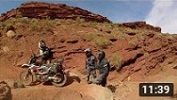
Continental Divide Route from Mexico to Canada over 13 days by adventure bike. This ride traverses the states of New Mexico, Colorado, Wyoming, Idaho, and Montana. YouTube version Higher quality/bandwidth personal library version Lower bandwidth version |
|
California BDR (modified) from Beatty to Yuma in 3.5 days YouTube version |
San Juan mountain passes of Colorado. Covering Ophir, Corkscrew, Hurricane, Engineer, and Imogene YouTube version |
Dual sport day rides
Death Valley: Eureka Dunes, Steel Pass, Saline Valley hot springs loop YouTube version |
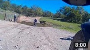
Donner Pass train tunnels YouTube version |
Latrobe Road adventure bike ride from Folsom through various Gold Country towns in El Dorado and Amador Counties. YouTube version |
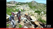
Lockhart Basin of the Canyonlands, Utah from Moab to the Needles outpost YouTube version Ennio Morricon "Spaghetti Western" personal library higher quality/bandwidth version Lower bandwidth version |
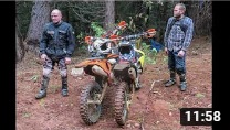 Muddy dual sport Meet-up ride from Placerville to the Bret Harte old hotel site via Mosquito road, then Georgetown via Rock Creek road. YouTube version |
Sheet Iron 300 (1st half) Stonyford to Fort Bragg YouTube version |
Sinkyone wilderness forest ride (Emerald Forest) by adventure bike of the California north coast YouTube version |
Sweetwater Mountains between Walker and Bridgeport, from Desert Creek to Lobdell Lake YouTube version |
White Rim Trail of Canyonlands National Park YouTube version |
Yuba River basin canyons from Nevada City to Downieville YouTube version |
Death Valley 3-day dual sport ride: Ridgecrest - Pahrump - Beatty loop YouTube version |
Morrison Divide technical trail off the Colorado BDR in the Routt National Forest YouTube version |
Disclaimer: Riding a motorcycle is inherently a dangerous activity and should only be done after proper training, in a sane manner, staying on designated trails, and with appropriate safety measures. Always wear a helmet and other necessary protective gear. The author of this website disavows any responsibility of information found here, and how it is used, or the consequences from the result of it. Not all the information here may be accurate and is provided as-is as a public courtesy, as mistakes are possible, and should not be relied upon without proper cross-checking through additional sources.
For participants, friends, or family of the
event related photography, feel free to contact me for additional content or
prints.
All content and images are property of Stephen Fischer Photography,
copyright 2013-2023. Last updated: 1/16/2023