Eastern Sierra dual sport ride - day 4
April 19-24, 2015
Day 4 ride: Volcanic tablelands north of Bishop
After two nights at
Green Creek, we broke camp that morning and headed for our next base camp
location near Bishop, ending up at a county park campground about 5 miles west of town.
Because we were still early in the camping season, most of the
national forest campgrounds were still closed.
Although this county park was a bit noisy, it ended up being
convenient for the showers, getting a well-deserved clean-up after three
days of riding. One other interesting presence at the camp were a
number of large and mostly nocturnal sphinx moths that seem to get into everything during the
evening hours (see pictured below). They seemed to be potentially attracted
to the black locust trees in bloom around our campsite.
 That day we set out to
explore the volcanic tablelands area northwest of Bishop via about an 80
mile loop that ends up close to Benton Hot Springs at its apex (but staying
off road) before returning
to camp. After topping off our
tanks in Bishop we headed north for about 5 miles along Highway 6, and then
5 Bridges Road, before breaking off onto the dirt up Fish Slough Road to the
north.
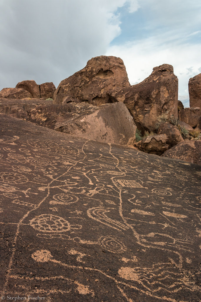
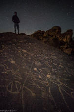
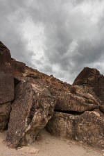
Along the way we did a short excursion out to
Sky Rock on a very
rocky and rough road, to one of the more interesting, yet mostly secret
petroglyph covered rock formations of the area.
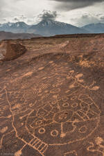
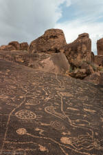
After taking some casual photos in the afternoon light, we continued
further north, stopping at more such petroglyph formations to explore and
photograph. The road to the
north was long and seemed to go on forever, being on the edge of the
tablelands to your left and Fish Slough to your right. Eventually we reached
an anticipated fork in the road shortly after the signed Chalafant
petroglyph rocks, taking the path to the west through Red
Rock Canyon. At this point the road becomes a bit more interesting for the dual
sports due to a narrowing canyon to ride through (although a full sized
adventure bike with trail tires should not have any issues either).
That day we set out to
explore the volcanic tablelands area northwest of Bishop via about an 80
mile loop that ends up close to Benton Hot Springs at its apex (but staying
off road) before returning
to camp. After topping off our
tanks in Bishop we headed north for about 5 miles along Highway 6, and then
5 Bridges Road, before breaking off onto the dirt up Fish Slough Road to the
north.
Along the way we did a short excursion out to
Sky Rock on a very
rocky and rough road, to one of the more interesting, yet mostly secret
petroglyph covered rock formations of the area.
After taking some casual photos in the afternoon light, we continued
further north, stopping at more such petroglyph formations to explore and
photograph. The road to the
north was long and seemed to go on forever, being on the edge of the
tablelands to your left and Fish Slough to your right. Eventually we reached
an anticipated fork in the road shortly after the signed Chalafant
petroglyph rocks, taking the path to the west through Red
Rock Canyon. At this point the road becomes a bit more interesting for the dual
sports due to a narrowing canyon to ride through (although a full sized
adventure bike with trail tires should not have any issues either).
After our next stop to put on another layer
and/or the liner in our jackets, we realized again we were running short on
time, with the weather also closing in and temperatures dropping quickly. We
had to abort some other planned more technical excursions in order to avoid
having to take this in the darkness. Instead we opted to take a more direct
path to reach Benton Crossing Road, saving the more
technical route for next time.
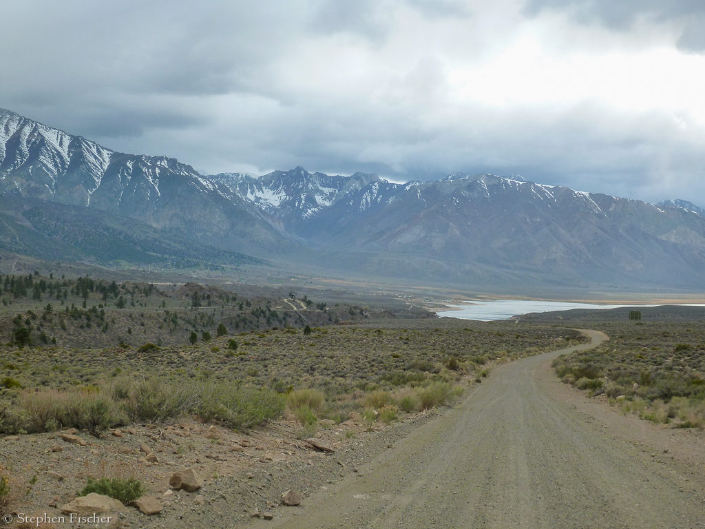
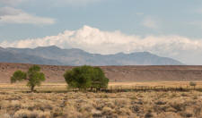
From the asphalt of Benton Crossing Road, we headed southwest for another
3~4 miles before branching
off again for another dirt road that eventually dropped us down into the
Owens River Gorge just below Crowley Lake, and then up again to Tom’s Place
along Highway 395. To help find our way through a network of dirt roads, the
Garmin GPS attached on my bike's handlebars via a Ram mount came in handy.
After reaching the highway, we just
made a beeline back to camp in order to expedite our return at dusk. About halfway back, Tucker’s KTM ran out of gas, having to switch to
reserve to complete the route. Randy
also had some spare fuel in a Rotopax on his back rack that we planned on
sharing if needed. I am sure it would
have been necessary for all of us if we had the extra time for the more
technical route.
<Continue with the
story...>
1
2 Prev Day (3)
Next Day (5)
Sky Rock |
Sky Rock (view 2) |
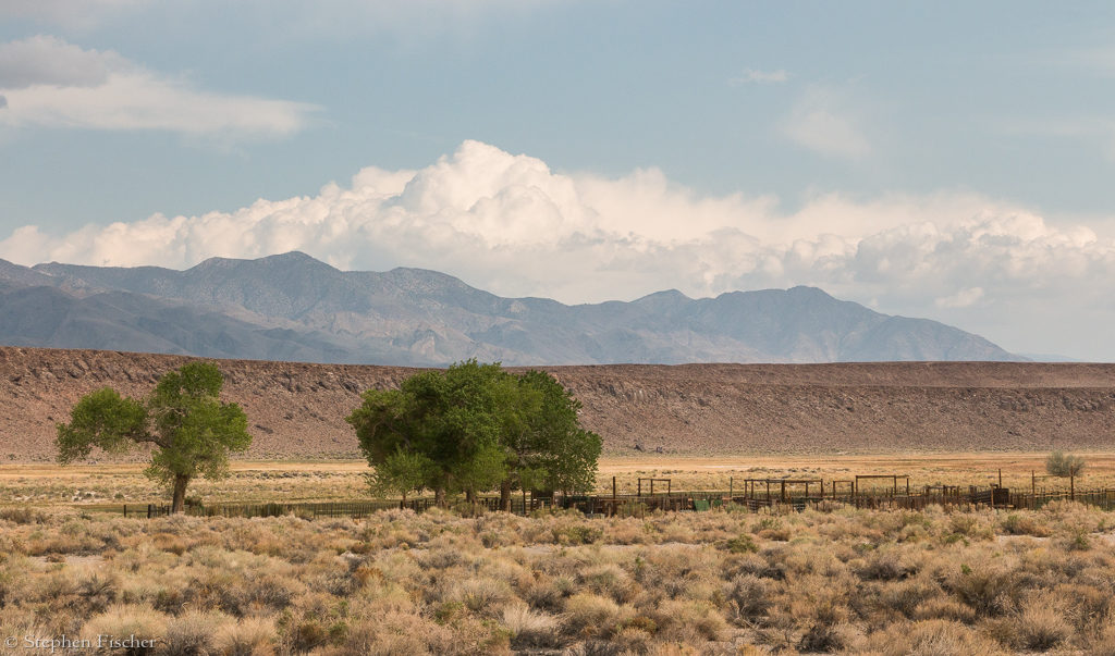
Fish Slough corral |
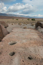
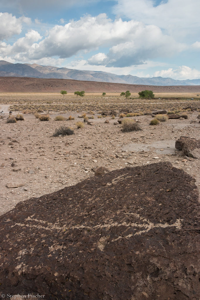
Grinding holes |

Fish Slough Petroglyph
human stick figure |
Chidago Petroglyphs |
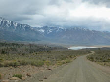
Descent to the Crowley Lake basin |
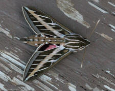
Sphinx moth |
1
2 Prev Day (3)
Next Day (5)