Picture of the week
| Previous weeks |
 Nov
17, 2013 Nov
17, 2013 |
|
|
|
|
 Oct
20, 2013 Oct
20, 2013 |
|
|
 Oct
6, 2013 Oct
6, 2013 |
|
|
|
|
|
|
|
|
|
|
|
|
| Older |

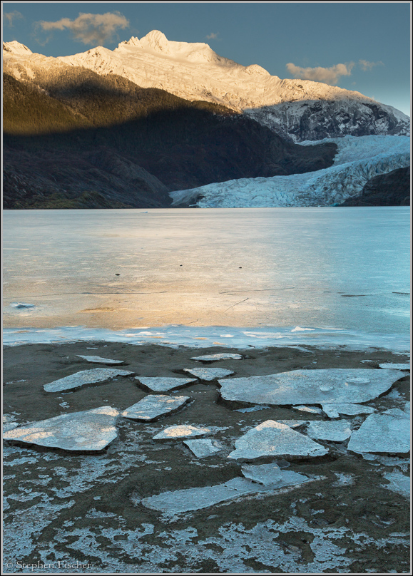
Mendenhall Glacial Ice
Fragments of ice from the shoreline of the lake at the base of Mendenhall Glacier. This glacier is part of the Mendenhall Glacier National Recreation Area and is just northeast of Juneau at the far end of Mendenhall lake. During the winter this lake freezes up, but the glacier continues to move at about 1.5 feet per day. As a result you can still witness calving from the glacier despite the frozen lake surface. During the winter the frozen lake is used initially by ice skaters, and then cross country skiers as more snow accumulates on the surface. But because of the glacier activity, recreational users tend to stay away from the northeast end of the lake due to the obvious hazards.
The glacier originates from the vast Juneau ice field. While the glacier calves off large icebergs that can be seen floating about the lake, overall the glacier is receding. According to wikipedia this glacier has receded 1.75 miles since 1958, while compared to 2.5 miles since about 1500. As this glacier has receded, the lake has formed at its base and grown larger over time as the space previously occupied by glacial ice is now water.
I happened to visit Mendenhall Lake a few days after it started freezing up, and before any snow has yet accumulated on the surface. You can explore the south side of the shoreline for about a mile from the visitor center up to the fairly dramatic Nugget Falls at the southeastern edge. The photograph above was taken in the morning, just after returning to Juneau from a 5 day trip in Haines for the purpose of bald eagle photography. A more extensive travelogue on this trip can also be found here: Juneau, Haines, and the Chilkat bald eagle preserve.
All content and images are property of Stephen Fischer Photography, copyright 2013. Last updated: 11/24/2013 ()