Picture of the week
| Previous weeks |
|
|
|
|
 Mar
27, 2016 Mar
27, 2016 |
|
|
 Mar
6, 2016 Mar
6, 2016 |
 Feb
21, 2016 Feb
21, 2016 |
 Feb
14, 2016 Feb
14, 2016 |
 Feb
7, 2016 Feb
7, 2016 |
 Jan
17, 2016 Jan
17, 2016 |
 Jan
3, 2016 Jan
3, 2016 |
 Dec
20, 2015 Dec
20, 2015 |
 Dec
13, 2015 Dec
13, 2015 |
 Nov
29, 2015 Nov
29, 2015 |
 Nov
22, 2015 Nov
22, 2015 |
| Older |
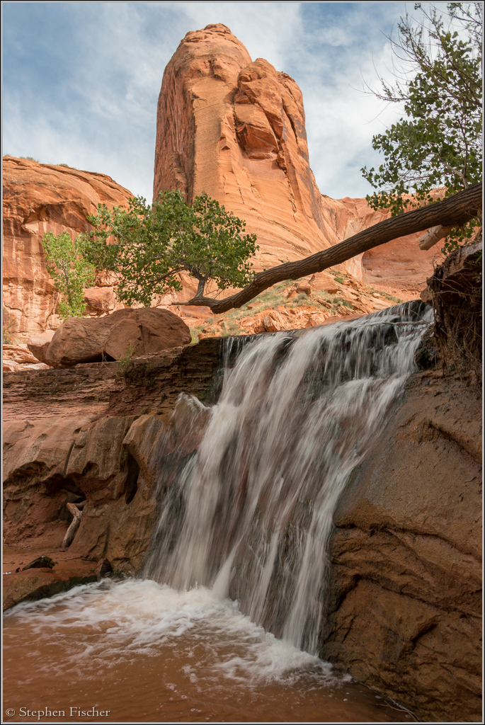
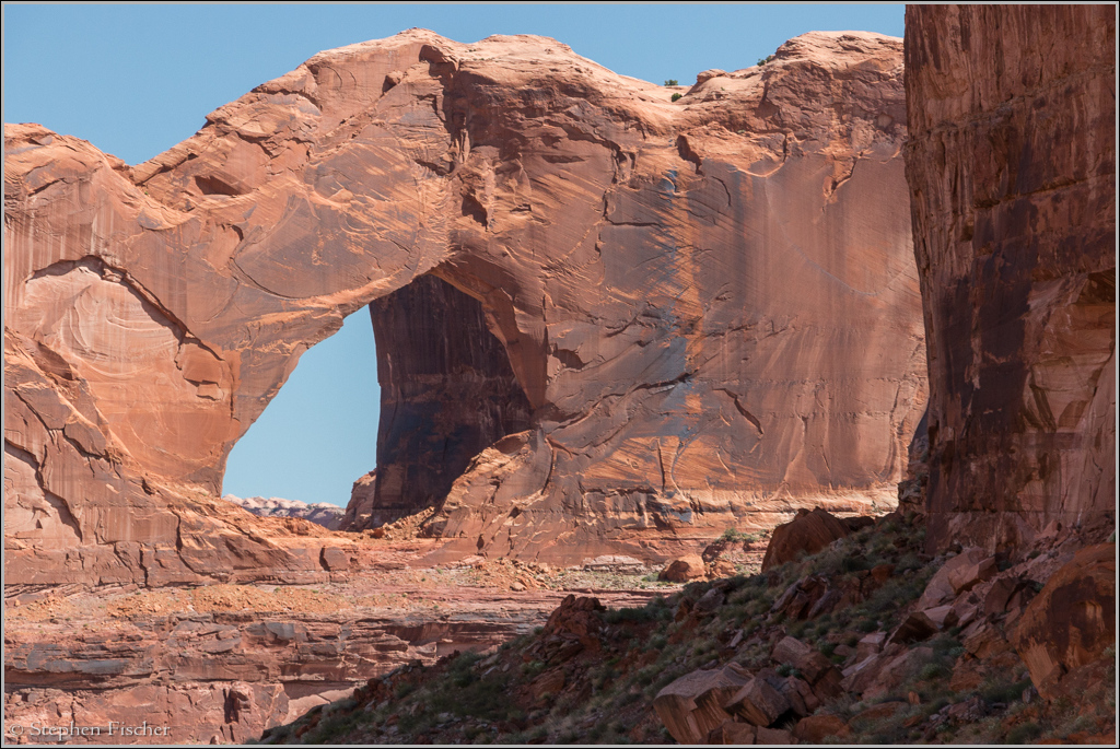
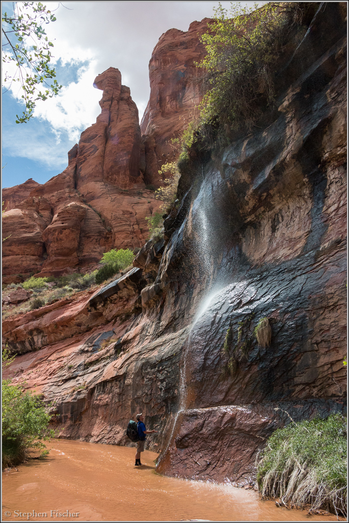
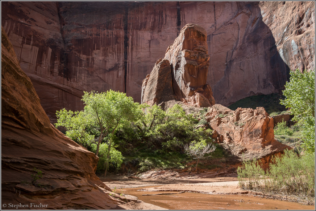
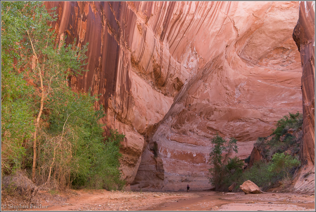
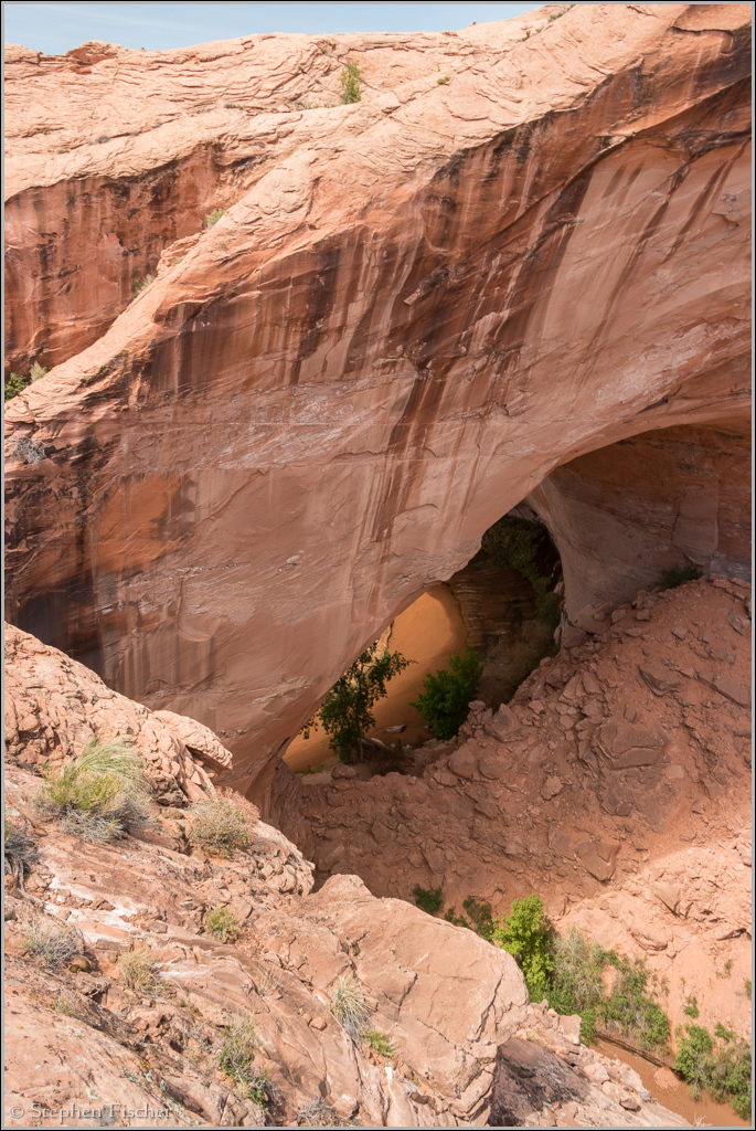
Coyote Gulch waterfall
One of many waterfalls found within Coyote Gulch of the Grand Staircase Escalante National Monument in Southern Utah.
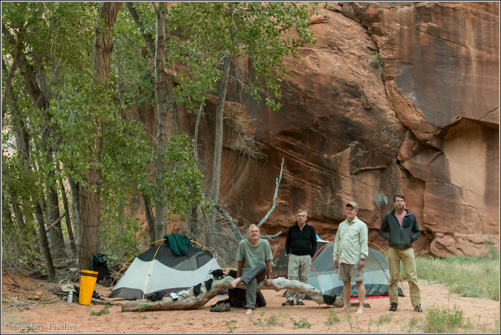
I just returned from a two day hike through this beautiful canyon with three other friends: John, Randy, and Don. The hike lived up to all the hype and expectations that I have read about and heard from others. It has been on my bucket list for a while, with this being my second try after canceling a planned trip last fall due to bad weather. This time the weather cooperated with lows in the 40's and highs in the 70's with mostly clear skies during the hike. You can get more details about the hike specifics at Tom's Utah Canyoneering Guide here.
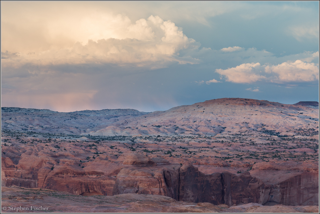
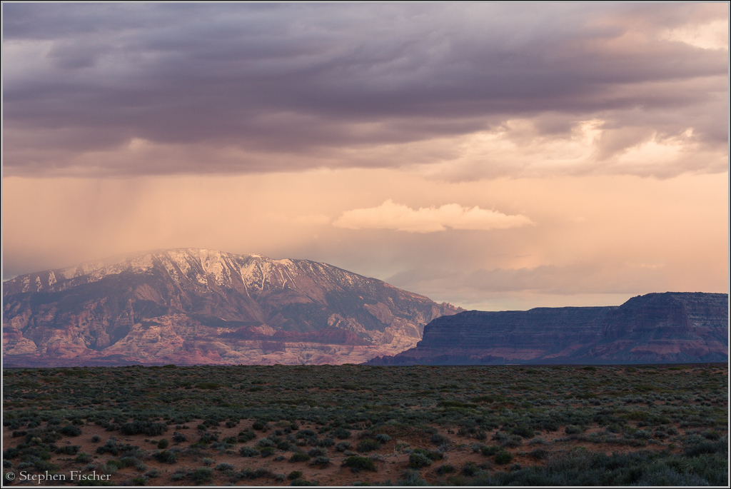
After picking up a permit and some wag bags at the Escalante BLM office the afternoon before the hike, we made our way to the end of the 40 Mile Trail Road near the southern end of Hole-in-the-Rock Road. We camped at the trailhead farthest to the east, and enjoyed the sunset with some photography of a storm system over Navajo Mountain to the south. Other than some winds, the storm skirted us to the east. In general, according to info from the BLM office, the drainage into the Coyote Gulch is not so dramatic that it is dangerous to enter when rain showers are present. The canyon is also wide enough that there are plenty of places to go to seek refuge in the unlikely situation you do have persistent and heavy rains that result in flooding.
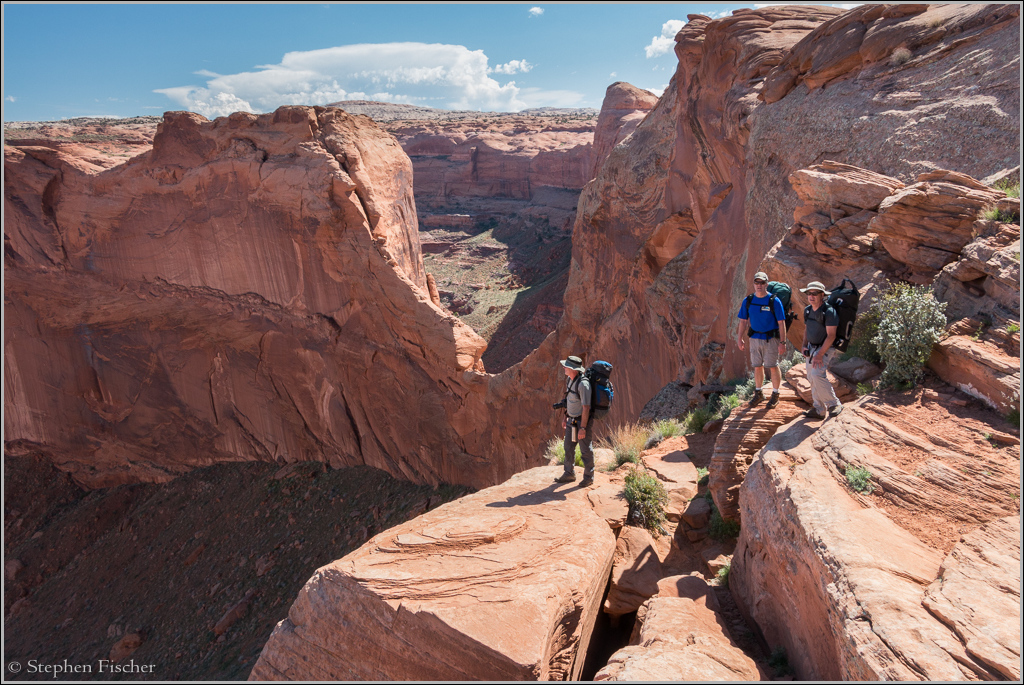
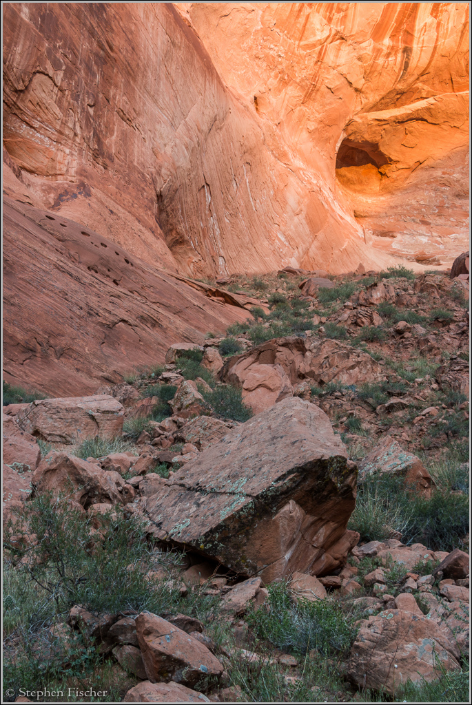
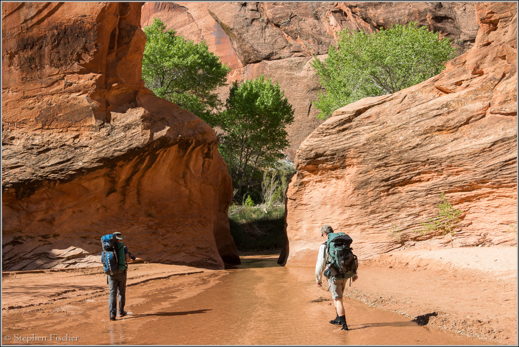
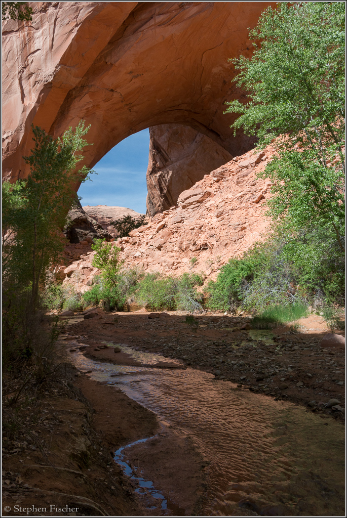
The next morning we hit the trail with a modest pace (having enough food for 3 days if needed), entering Coyote Gulch via the Crack-in-the-Wall path after about 2 miles. This was sufficiently narrow and steep that we needed to remove our packs and lower them separately via a line to a person at the bottom. This path may be difficult for those with a wider girth, and going up it I would expect some chimneying would be required if you don't have enough upper body strength. Once at the bottom of the gulch after descending a steep and sandy grade for another 3/4 mile, we dropped our packs, put on our water shoes (I use Keen sandals with Seal Skin socks to keep the grit off), turned right, and did a bit of exploration up the Escalante River to Steven's Arch after reaching its confluence to the east in about another 1/2 mile. To view this arch from the bottom required crossing the thigh deep Escalante River via a trail through some tamarisk to the left at the confluence.
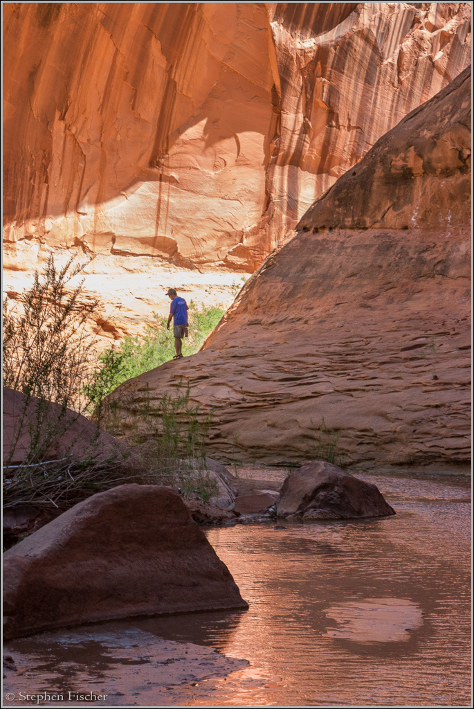
For the next day and a half we then headed up Coyote Gulch to the west, hiking mostly in ankle deep water, with some occasional ups and downs on some sandy shoreline trails. Along the way we would run into an occasional hiker or camper at some of the more scenic locations, but for the most part others were fairly dispersed. After finding a fairly secluded camp site off the trail and setting up camp, myself and John decided to do a bit of evening photography without the burden of our packs. While up the trail at about 6pm, we ran into a couple that were day hiking and tried to return via the steep path they descended via the "sneek path", but said it was too steep to get back up it. They asked how far it was to the exit via the Crack-in-the-Wall route. After replying it would probably be about 5 hours back to the nearest trailhead, they said goodbye and continued on. I presumed they had come down the steep path near Jacob Hamblin arch that we planned on exiting the next day, but they were gone before I could talk further.
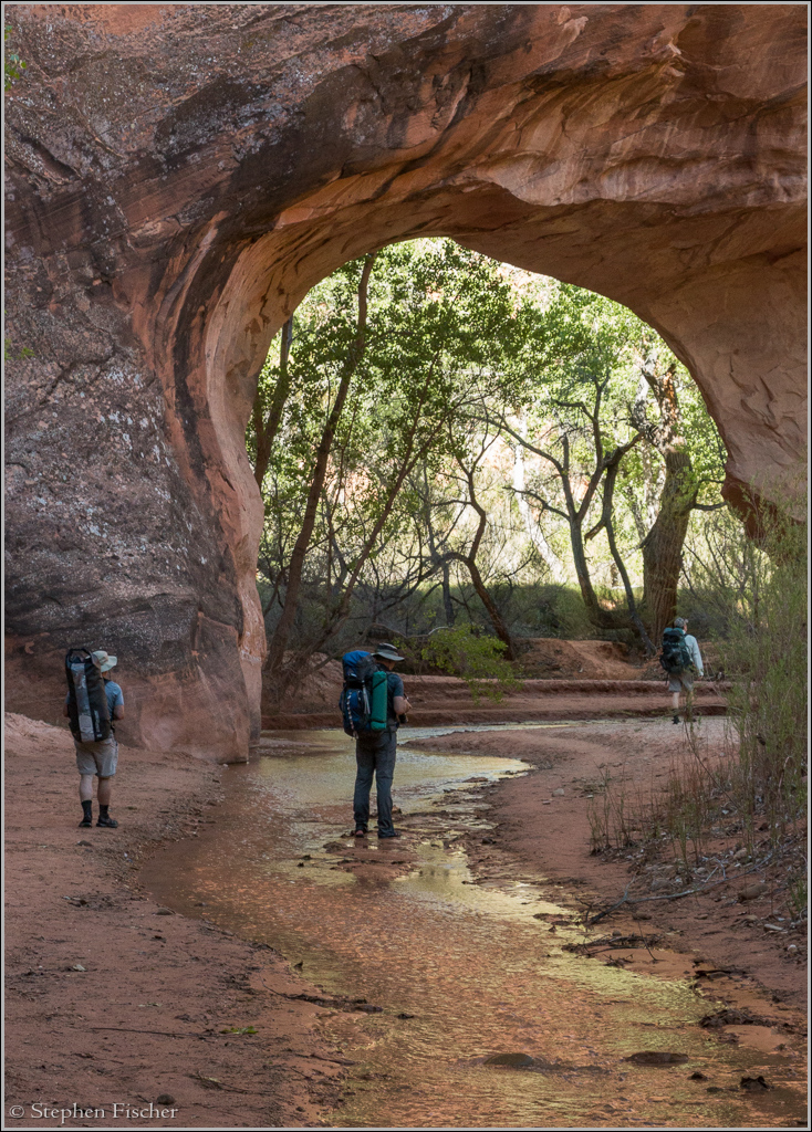
The next day we reached the natural bridge arch, crossing through it, and by lunch the enormous Jacob Hamblin arch. This area tended to be the most popular with a couple of different campsites about, with Don noticing a slight whiff of ammonia in the air. Running into a hiker on vacation from the National Forest Service Bridgeport office earlier in the day, he mentioned the composting outhouse that used to be here was burned down a few years back by a group of Boy Scouts.
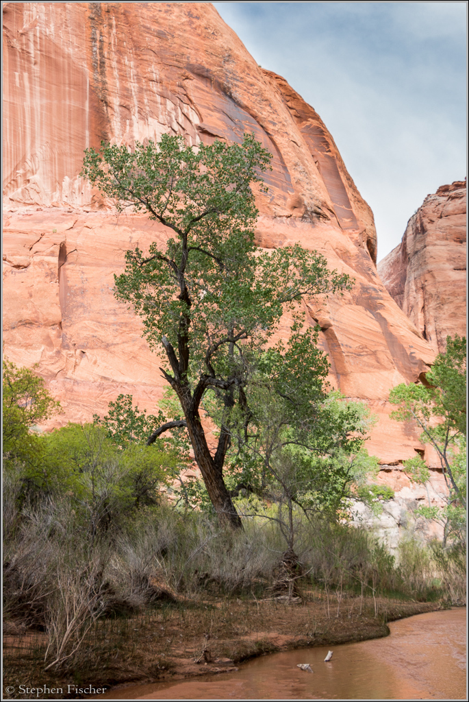
Our planned exit was via a steep grade just east of the arch, roughly a hundred feet to the east and south of a small spring. But before exiting, we explored further up Coyote Gulch for another couple of bends, encountering additional scenery well worth the extra detour. In general our group found the scenery to be quite nice for most of the hike between the Escalante River and up a few bends past Jacob Hamblin arch.
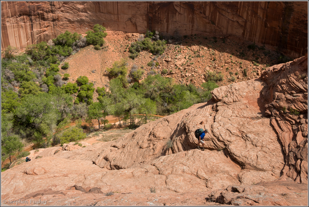
After the encounter with the couple that failed to get up this exit the day before, some of us were now a bit anxious about the difficulty with our packs. With the alternative of either having to double back the way we came, or an extra 6~8 miles by finding an easier exit further to the west toward Hurricane Wash, we felt the steep route would be worth the shot, especially since earlier reports I had indicated it to be doable for someone with reasonable agility and confidence on steep terrain. According to Tom's Utah Canyoneering Guide, this exit route is rated at 5.4. Depending on your understanding of this rating system, that could imply technical rope work (per the High Sierra Climbers Guide), or free climb with available hand and/or footholds. If you follow the Yosemite Decimal Rating System (YDRS) definition per Climbing Techniques.org, then I think it falls more into category 4. Below is a set of definitions I found here that gives enough latitude that one could justify the 5.4 rating. So I guess there are some inconsistencies in different people's understanding of these climber rating systems. Like that in other endeavors, perhaps this is another field where we are seeing some grade inflation....
Class 4: Exposed climbing, following a ledge system for example. A rope would be used to belay past places where a fall could be lethal
Class 5: This is where technical rock climbing begins. A 3 point stance (Two hands and a foot or two feet and a hand) is needed. A rope and protection are needed to safeguard a fall by the person leading. Any unprotected fall from a class 5 climb would be harmful if not fatal. Class 5 climbs are subdivided into categories to give more detail.
5.0-5.4: Climbing up a ramp or a steep section with good holds.
After switching back to our dry hiking boots with better grip, we set out on the exit. We didn't use a rope, and compared to some other routes we have taken on steep sandstone in the past, it did not present us with much difficulty. There were some cracks and handholds we were able to find to get started at the steepest sections near the beginning, requiring to be on all fours in a couple of occasions, but otherwise the climb out was fairly routine. Thinking back about the difficulty the couple faced the day before, I suspect the real issue may have been a fear of heights versus technical difficulty.
After reaching to top of the canyon, it was another 2.5 miles across the open desert back to our car at the trailhead, with the route a mix between slickrock and sand. For those parked near the water tank nearer to the Jacob Hamblin exit, it is still about 2 miles from the top, so it is more efficient to just make a beeline to where you started versus using the road that would probably add another 2 miles.
For this particular trip I used my preferred backpacking camera setup, consisting of a Canon EOS 70D with an EF-S 18-135 IS STM lens with a polarizer, Gitzo G1128 mk2 tripod, cable release, and Really Right Stuff BH-25 Pro ballhead. It is fairly light with a total weight of 6 lb, 13 oz (including an extra battery, neoprene case, grad ND filter and holders), while enabling good quality captures. The lack of a wide angle lens did limit a few compositional possibilities, but for the most part the 18-135mm lens on the cropped body provided ample flexibility and reasonable IQ. Usually I was able to compensate by standing further back when constrained on the shorter focal lengths. Since I was with three others and did not want to hold up the pace, I skipped the use of the tripod during the day while hiking, saving it for only the later evening photography. For the most part while handheld, I was able to keep the ISO setting in the 200-400 range, with an occasional excursion up to 1600 in some of the deeper canyons, while keeping the polarizer on the entire time. As an example, the image above was captured handheld while kneeling with settings of 18mm, ISO 200, f/14, and 1/20th of a second.
Next week I will cover another leg of this Southern Utah trip: Technical descent down Neon Canyon from the top.
For information and photographs of other Utah canyon explorations myself and friends have taken, please see my compendium on Slot Canyons of the Colorado Plateau.
All content and images are property of Stephen Fischer Photography, copyright 2010-2016. Last updated: 4/18/2016 ()