Picture of the week
| Previous weeks |
|
|
 Aug 17, 2014 Aug 17, 2014 |
 Aug
10, 2014 Aug
10, 2014 |
 Aug
3, 2014 Aug
3, 2014 |
 July
20, 2014 July
20, 2014 |
 July13,
2014 July13,
2014 |
 June
29, 2014 June
29, 2014 |
 June
15, 2014 June
15, 2014 |
|
|
 June
1, 2014 June
1, 2014 |
 May
25, 2014 May
25, 2014 |
 May
11, 2014 May
11, 2014 |
 Apr
27, 2014 Apr
27, 2014 |
| Older |
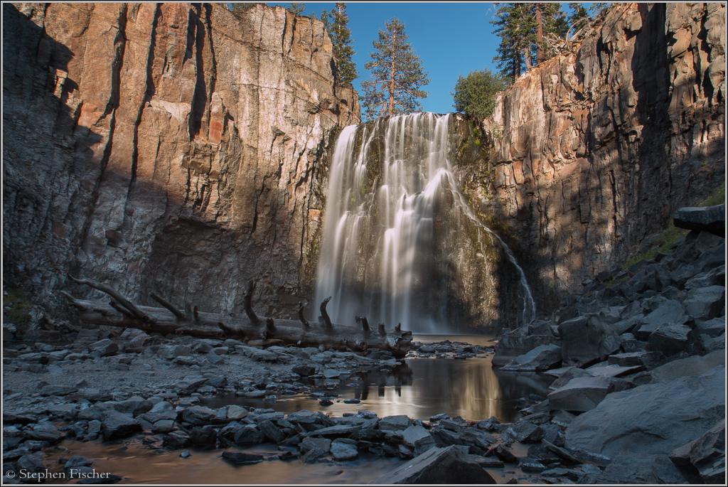
Rainbow Falls
Rainbow Falls, south of the Devils Postpile National Monument. This waterfall is on the middle fork of the San Joaquin River just west of the boundary for the sierra divide. Even though it is accessed by a mile hike from the end of the road via Devil's Postpile National Monument on the eastern side of the sierras just outside Mammoth, surprisingly the water here flows to the west, ultimately feeding the main San Joaquin River. Historically this flowed all the way to the Pacific Ocean via the Sacramento delta. But due to all the downstream diversions on this river for agriculture, including that facilitated by the Friant dam above Fresno, it currently dries by the time it reaches the San Joaquin Valley. There is an effort to restore the flows down this river to the Merced that started in a federal program in 2011 with a goal for the salmon to run again all the way up to the Friant dam. But due to the recent drought conditions this year, this effort has been temporarily stopped in order to ensure local municipalities in Fresno and Tulare county will have enough water for basic services and some of the more critical ag crops such as the citrus orange groves.
This waterfall flows over balsaltic volcanic rock. It is unusual due to its sheer drop off with steep canyon walls on both sides. Over the course of millions of years the ledge of this fall has receded backwards, exposing more of the canyon walls, and thus gradually enlarging the size of it over time. I visited these falls prior to a hike into the high sierras last year to the Minarets Lake basin about this time last year. It would be interesting to see how the flow of this waterfall has changed this year due to the extreme drought conditions?
In a couple of weeks I will be back in the high sierras again for some more backpacking and photography of some new areas. Stay tuned...
All content and images are property of Stephen Fischer Photography, copyright 2014. Last updated: 9/8/2014 ()