Picture of the week
| Previous weeks |
 Aug
3, 2014 Aug
3, 2014 |
 July
20, 2014 July
20, 2014 |
 July13,
2014 July13,
2014 |
 June
29, 2014 June
29, 2014 |
 June
15, 2014 June
15, 2014 |
|
|
 June
1, 2014 June
1, 2014 |
 May
25, 2014 May
25, 2014 |
 May
11, 2014 May
11, 2014 |
 Apr
27, 2014 Apr
27, 2014 |
 Apr
20, 2014 Apr
20, 2014 |
|
|
 Apr
6, 2014 Apr
6, 2014 |
| Older |
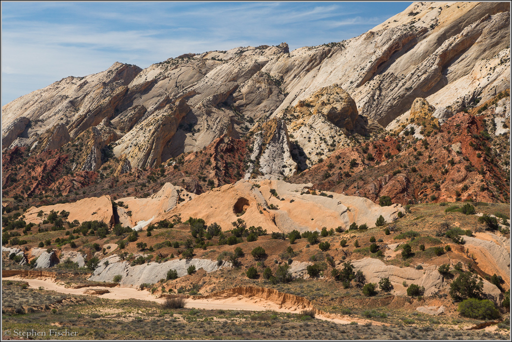
Capital Reef tilted rock
Multi-colored layers of sandstone in an area known as Waterpocket Fold at Capital Reef National Park. This unusual set of layers represent a buckeling of the earth's surface along a fault line. The rock layers on the higher right (west) side are about 7000 feet higher than those on the east side. This type of large change in elevation due to uplifting on one side of a fault line is called a monocline. The initial uplift started about 50 to 70 million years ago during the geological phase known as the Laramide Orogeny. During the more recent geological period that resulted in the Colorado Plateau about 15 to 20 million years ago, the different geological layers of this fold along this monocline were exposed. Most of these layers are composed of sandstone, representative of ancient river, lake, and sea beds deposited over time. The term for "reef" is reflective of the early formative layers where this rock was at the transition between water and land. The layers to the east (left) are considered younger than the layers to the west. This is a summary of a more detailed one found at the National Park Service website for Capital Reef National Park here.
 This
colorful folded fault line runs north-south nearly 100 miles as more evident
at the southeast corner of the park along Norton-Bullfrog road. I
traveled through this area during another exploration through Capital Reef
National Park, starting in Cathedral Valley that morning, dry camping over
the previous night, and then afterwards traversing the park along the Burr
Trail. The place is a wonderland of different geological formations,
but at the same time one of the less visited national parks. For these
reasons it is also a good place to go in southern Utah if trying to escape
the crowds at the more popular National Parks of Arches, Zion, and Bryce.
This
colorful folded fault line runs north-south nearly 100 miles as more evident
at the southeast corner of the park along Norton-Bullfrog road. I
traveled through this area during another exploration through Capital Reef
National Park, starting in Cathedral Valley that morning, dry camping over
the previous night, and then afterwards traversing the park along the Burr
Trail. The place is a wonderland of different geological formations,
but at the same time one of the less visited national parks. For these
reasons it is also a good place to go in southern Utah if trying to escape
the crowds at the more popular National Parks of Arches, Zion, and Bryce.
All content and images are property of Stephen Fischer Photography, copyright 2014. Last updated: 8/11/2014 ()