Lower Baptist Draw through Upper Chute Canyon
Stephen Fischer Photography
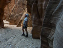
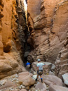
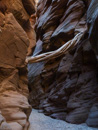
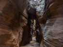
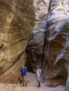
Once down in Upper Chute, we decided to explore the northern leg, despite the planned route requires us following the southern leg. This diversion ended up being well worth it, as the canyon is quite dramatic with extremely tall walls, and getting extremely tight in places. We explored this until reaching a more open area before turning around. There were a few technical class 2 areas on this northern leg, but nothing requiring a rap to get by.
After doubling back the north leg of Upper Chute and returning to the junction with Baptist Draw (taking about 1 extra hour), we stopped for lunch. There we met another two canyoneers from Colorado who were taking the shorter loop to the north. They indicated that from the junction it would only take about 2-3 hours to get back to the trailhead.
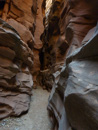
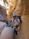
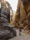
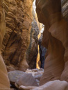
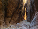
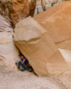
We then pressed on down the southern leg of Upper Chute, encountering a 20' pour-off shortly after that required another rappel. In all these cases, we found existing anchors all in sufficient condition to not require any type of retrofit or redo. This ended up being the final rap for the day, with the remainder of the hike down Upper Chute encountering one very large slot canyon after another, going on for a couple of miles. In my limited experience so far, I don't recall finding a slot canyon so consistently deep or long as this one.
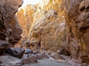
After reaching the junction with Fault Canyon, we followed this to the west on the way back to the trailhead. At this point, the GPS indicated we had about 2 miles as the crow flies. But as we progressed up Fault, the distance did not change that much as we were moving roughly perpendicular to the initial trailhead. After about 2 miles of a slow climb up the bottom of Fault Canyon we found our exit point to the north. From there we bushwacked the terrain up to the rim of this canyon, encountering many areas of loose rock and areas requiring some skirting in order to get over a number of ledges.
At this point we were up on the mesa, but on a finger extending out to the east. To reach our vehicle, we still had to descend into one more canyon and then back up the other side. This ended up taking another hour before finally reaching our starting point. It had us all wondering if this was the most efficient way to do this hike, or perhaps we should have stayed up on the mesa and just increased the travel distance on flat terrain walking along the rim of it instead. Or alternatively start the hike closer to the proper exit from Fault canyon as one of the other route descriptions suggested?
All content and images are property of Stephen Fischer Photography, copyright 2014. Last updated: 11/21/2014