Picture of the week
| Previous weeks |
 Apr
15, 2018 Apr
15, 2018 |
 Mar
18, 2018 Mar
18, 2018 |
 Feb
25, 2018 Feb
25, 2018 |
 Feb
11, 2018 Feb
11, 2018 |
 Dec
12, 2017 Dec
12, 2017 |
 Nov
19, 2017 Nov
19, 2017 |
 Nov
5, 2017 Nov
5, 2017 |
 Oct
22, 2017 Oct
22, 2017 |
 Oct
15, 2017 Oct
15, 2017 |
 Oct
1, 2017 Oct
1, 2017 |
 Sept
10, 2017 Sept
10, 2017 |
| Older |
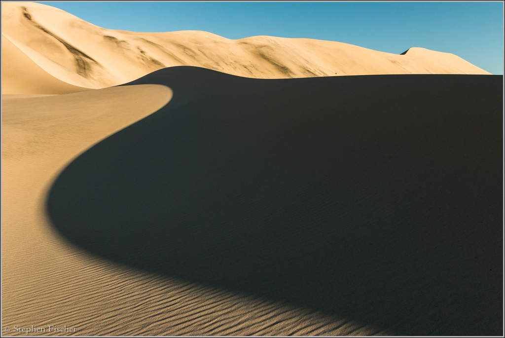
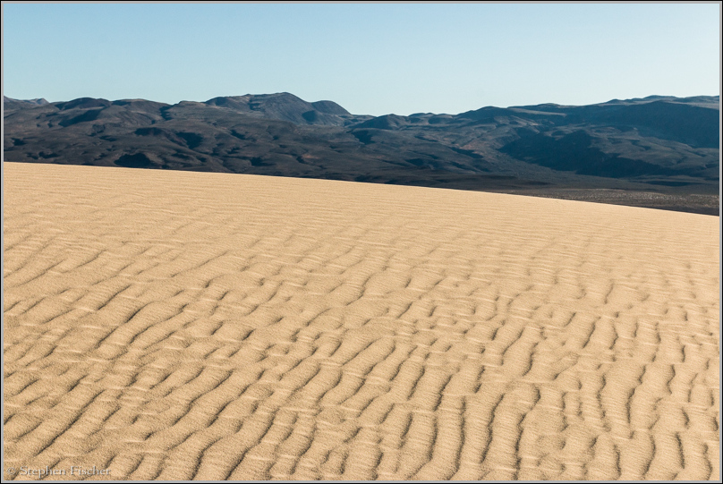
Desert contours
The Eureka Dunes partially in shadow near sunset at the northen end of Death Valley. This is one of my favorite locations for photography in Death Valley. Due to its remote location it is less visited, and thus less tracked. Higher winds also tend to be more typical here, erasing whatever footprints may have existed from the previous days. This also means that camping out here can be a bit more brutal due to blowing sand. It should also be mentioned that there is no water or other facilities to speak of, with the exception of a sole outhouse (but bring your own toilet paper!).
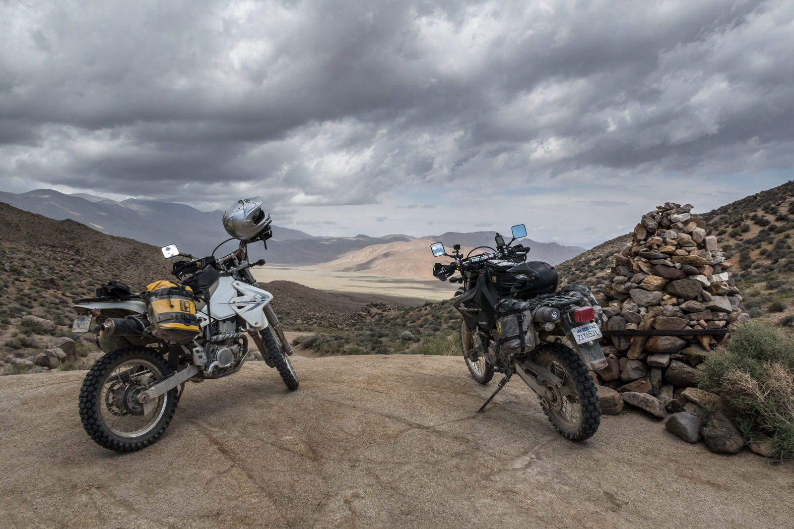 I visited this area last week as part of a week long dual sport
motorcycle adventure trip, dry camping along the way in a mix of
weather conditions. From
here, we crossed over Steele Pass behind the dunes via a rough
4wd trail before dropping into Saline Valley to the south,
visiting the hot springs there to relax and clean up before
moving on. Subsequent travels took us further south to the
Racetrack, Lippencott Pass, Hunter Pass, Panamint Valley,
Darwin, Ballarat, Barker Ranch, Mengel Pass, Warm Springs
Valley, Bad Water, Furnace Creek, and Cerro Gordo. Much of
this terrain is rough, only passable with such a bike or high
clearance 4wd vehicle. You can read and learn more about
my motorcycle based travels and details of many routes at the
Motorcycle
Corner.
I visited this area last week as part of a week long dual sport
motorcycle adventure trip, dry camping along the way in a mix of
weather conditions. From
here, we crossed over Steele Pass behind the dunes via a rough
4wd trail before dropping into Saline Valley to the south,
visiting the hot springs there to relax and clean up before
moving on. Subsequent travels took us further south to the
Racetrack, Lippencott Pass, Hunter Pass, Panamint Valley,
Darwin, Ballarat, Barker Ranch, Mengel Pass, Warm Springs
Valley, Bad Water, Furnace Creek, and Cerro Gordo. Much of
this terrain is rough, only passable with such a bike or high
clearance 4wd vehicle. You can read and learn more about
my motorcycle based travels and details of many routes at the
Motorcycle
Corner.
 If you wish to learn more about where to go for photographing
Death Valley, or any other areas in California, then check out
my book available on Amazon
here.
WIth over 250 locations covered with 45 separate maps with many color
reference images, a wide range of landscape and wildlife locations are
documented.
If you wish to learn more about where to go for photographing
Death Valley, or any other areas in California, then check out
my book available on Amazon
here.
WIth over 250 locations covered with 45 separate maps with many color
reference images, a wide range of landscape and wildlife locations are
documented.
More images (click to select the larger view at the bottom)


All content and images are property of Stephen Fischer Photography, copyright 2010-2018. Last updated: 4/29/2018 ()