Yolo Basin Wildlife Refuge
This is a convenient
location for bird photography for those local to the Davis and Sacramento
region. The best opportunities
exist between September and March with the peak time during the winter. It
is also adjacent to a duck hunting preserve, so during the duck hunting season around
October and November, some areas are off limits. You will notice the
birds become much more edgy after the hunting begins, so approachability of
some birds species for photography can be more difficult. During the summer
season, it is also a popular location for viewing bats. The bats come out by the
hundreds of thousands from underneath the west end of the Yolo Causeway bridges.
 You get here from the exit off of Interstate 80 closest to the western edge
of the causeway that runs between Davis and Sacramento. The entrance is on
the south side of the freeway just east of the fruit store. It is up and
over the dirt levee road. There is gate that is controlled by the fish and
wildlife personal that is typically opened at around sunrise but can vary, so
plan accordingly.
You get here from the exit off of Interstate 80 closest to the western edge
of the causeway that runs between Davis and Sacramento. The entrance is on
the south side of the freeway just east of the fruit store. It is up and
over the dirt levee road. There is gate that is controlled by the fish and
wildlife personal that is typically opened at around sunrise but can vary, so
plan accordingly.
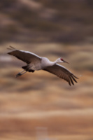
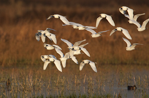
Birds you may find here include: Great Blue Heron, Great Egret, Snowy Egret,
Cattle Egret, White-faced Ibis, Norther Harrier, Red-tailed Hawk, Swainson
Hawk, Virgina
Rail, Common Moorhen, Sora, Northern Pintail, Blue Winged Teal, Green Winged
Teal, Cinammon Teal, Mallard, Northern Shoveler, Gadwall, American Wigeon,
Eurasian Wigeon, Lesser and Greater Scaup, Canada Goose, Snow Goose, White
Pelican, Black Crowned Night Heron, Green Heron, American Bittern, Lesser
Bittern, Avocet, Black necked Stilt, Long billed Dowitcher, Greater
Yellowlegs, Pied-billed
Grebe, Eared Grebe, American Coot, Marsh Wren, Red-winged Blackbird,
Tri-colored blackbird, Western Meadowlark, California Quail, Killdeer,
Horned Lark.
 Favorite locations that have
worked for me include:
Favorite locations that have
worked for me include:
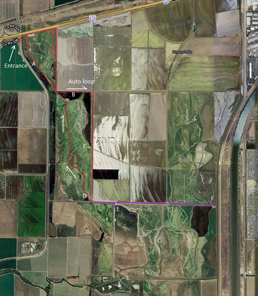
- On the west side of the
road just past the entrance (marked 'A' on the map). This
generally only is good when the area on this west side is sufficiently
flooded.
- Follow the from the
entrance to where it makes the first bend to the left and take this.
Then as you drive due east, look through the tules to your right (marked
'B'). There are
some exposed areas here that can provide some nice opportunities.
- Make the next right and
drive about 1 mile further south. You should see a parking area on your
right that also has a porta-potty (marked 'C' on the map). This is a good
open spot for some of the more flooded areas. With a big lens you can
pick-off quite a few different species from here. It is also a nice
location to setup for at first light in the morning when some species first
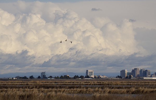
take flight. It is not unusual to see egrets, ibis, geese, and sometimes
cranes by the dozens in air at fairly low altitudes from this location.
- Next follow the road
further south to where it will fork to the left or loop back to the right.
During hunting season, the road is closed (marked purple) that provides access further to
the south and west, so you will end up having to loop back here to the
right. But if the road is not closed, then location 'E' on the map
provides some nice opportunities for more waders and some of the shyer birds
such as Bitterns and Rails. You may also find some of these birds on
the edge of some of the reed thickets back in area 'B' on the map.
- At the bend back to the
north, the flooded area to your right is nice for black necked stilts,
avocets, Ibis, and various sandpipers. These tend to be more aloof and
somewhat easier to approach.
While out here, also keep an
eye out for beaver and river otter that also frequent the sloughs between
some of the flooded areas.
For more detailed
information about the Yolo Basin wildlife refuge follow the link found
here.
To see more high quality
bird related images, you can visit my bird gallery here: