Cosumnes River Preserve
One of the advantages of bird photography at a preserve like Cosumnes is the more protected environment afforded the birds provides a more friendly environment for photography. Although the birds will still be nervous (probably due to nearby hunting grounds) and can still be difficult to approach, you will find a positive difference compared to areas farther away.
 This nature preserve is located long the
 To
get here from Sacramento head south on Interstate Highway 5, and take the
exit at Twin Cities road, crossing over to the east side of the highway.
Drive less than a mile and make a right on
 There
are several areas that one can explore at this refuge for birding and bird
related photography. From the
visitor’s center, there is trail that starts to the left on a bridge that
crosses a small slough behind the building.
This then leads to an opening at a larger pond with trails leading
both to the left and right. The
right path leading to the south will take you deeper into the park and a
network of trails eventually leading out to the Cosumnes river.
It is a mix of deep woods, grassy oak studded woodlands, and marshy
areas with tall reeds and cat tails.
You will find a variety of birds (and some otters and beavers) given
the diversity of vegetation and terrain.
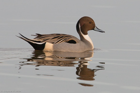
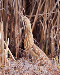
In the pond it is common to find a variety of ducks and some more
elusive birds in the reeds like bitterns and rails.
In the trees you will find a wide variety of woodpeckers, towhees,
warblers, and owls. Back at the
pond if you take the trail to the left, then this will eventually loop back
out to the road, bringing you to the first parking area across the road.
On this path you may find a higher density of swallows and warblers
in the more open areas with the possibility of spotting some egrets and
herons as you cross the road and enter the more marshy areas.
From this parking area, there is another trail that leads out to the
west with flooded areas on either side of you.
Here you will find a variety of ducks, wading birds like yellowlegs,
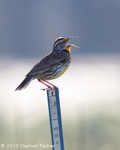
avocets, and stilts, along with blackbirds and meadowlarks.
 If
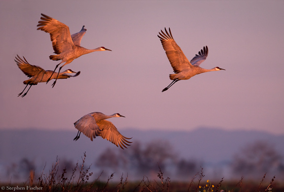
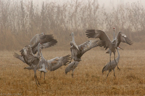
you are interested in photographing Sandhill Cranes, then your best
opportunities will be either at sunset as they fly in for their evening
roost, or at sunrise during their morning fly-out from these same
roost locations. They roost in the water for the night to better avoid
predators and tend to be located a little further from the roads and other
human accessible locations. For
that reason you will need a big lens (400mm or larger) in order to get
reasonably good photographs.
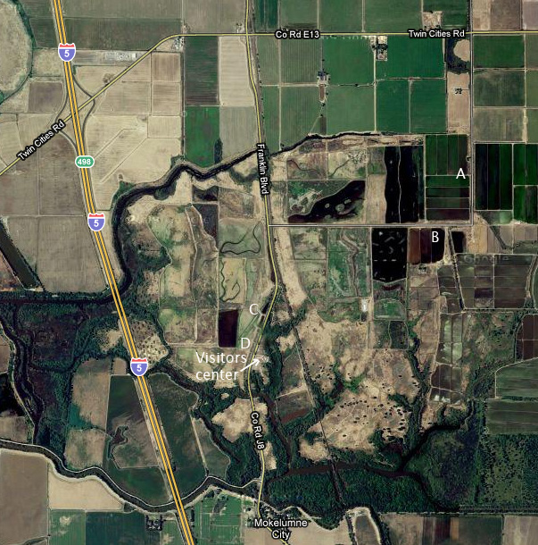
Two of the best locations for the evening fly-in will be either be at a
small observation deck located across the road from the visitors center
(marked 'D' on the map), or
from the first parking area about 100 yards north of the visitors center
(marked 'C').
Many of the Cranes may come in from the west or south, and these viewing
locations provide a nice spot to capture them in flight as they come in to
land. The biggest challenge
will be having enough light to get good photographs as some of them land
after sunset. So having a fast
lens and camera with good high ISO performance will help.
For
the morning photography of Sandhill Cranes, try to position yourself with the sun behind
you to get frontal or at least side lighting on the birds.
At first light in the morning, the color of the light striking the
cranes can be very nice. Another
good location for this morning fly-out photography is actually out on
Bruceville road about 1 mile north-east of the preserve as marked as
locations ‘A’ and ‘B’ on the map.
There are some flooded areas here off the road where you can get
within reasonable range. You
will need to get here and setup before sunrise as the birds are pretty
punctual on their departure time around sunrise.
As a handy tip, typically one or more of the cranes in a group
will start to lean forward in the direction of take-off for about 30-60
seconds before flight.
Another nearby popular location for waterfowl
including cranes can be found off of Staten Island Road. This is about
a 7 mile dirt road to the south off West Walnut Grove Road about a mile east
of Walnut Grove. You can get to it from Cosumnes River Preserve by
continuing on Franklin Blvd (which becomes Thornton Road) to the south for 3
miles until it tees with West Walnut Grove Road near the next junction with
I-5, and then head west for about 4 miles.
 If you are interested in seeing Sandhill Cranes in the middle of the day,
then they will typically be found foraging for food in the surrounding farm
land. One popular location is
out toward the west end of
For more detailed information about the Cosumnes River wildlife refuge by the fish and game department, then follow the link found here.
All content and images are property of Stephen Fischer Photography, copyright 2009-2015. Last updated: 12/20/2015
